Short Description:
Rubble layer under 2304 at NE end of trench 2 west
Issued to
Bill Balding | 18/09/2021

Interpretation
-
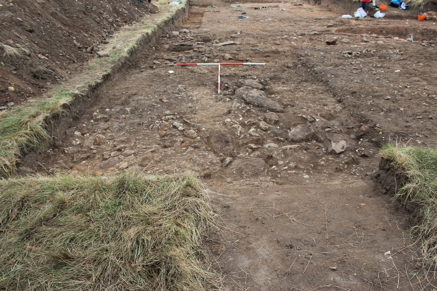
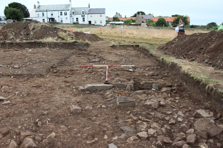
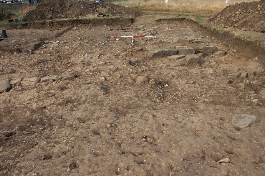
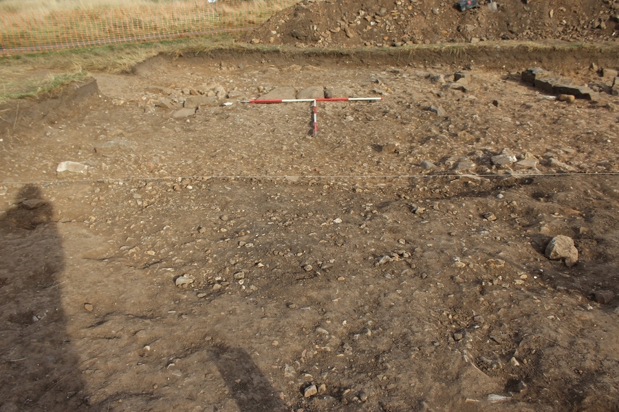
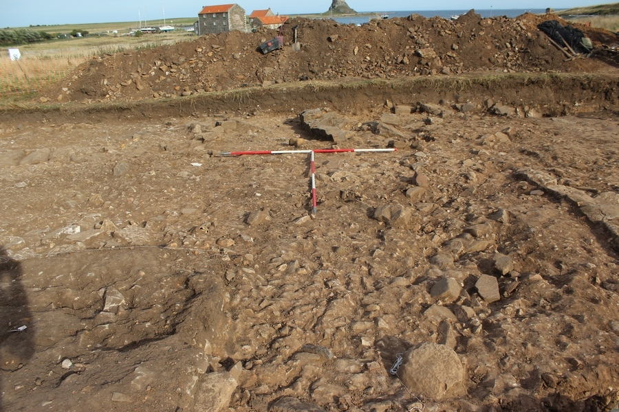
- This layer of rubble was visible capping all the features in the Northern extension of Tr2(W) underneath overburden 2304. Upon its removal, the edge of the limekiln cut F217 and possible wall 2345 and Eastern flue 2346 were visible
-
- Ben Swain
- 24-9-2021
Sketch Photo
Stratigraphic Matrix
Equal To
No Linked Records
Description
- Moderately compacted
- Light Reddish brown
- Clayey silt
- 30-40% inclusions of small to medium sized sub angular
- Within LOE Length - 12.00m Width - 7.00m Thickness - 0.13m
- partially excavated as of 2021
- Hand Ex/dry
Finds
| Findtype | Quantity (No. fragments) | Weight (g) | Notes |
|---|---|---|---|
| Animal Bone | 76 | NOT YET CLEANED. Not yet weighed. (Year 2022) | |
| Bone | 119 | 140 | Mixed human/animal. (Year 2022) |
| Ferrous Object | 1 | 7 | Nail. (Year 2022) |
| Other (add to description) | 2 | 10 | Fossil. (Year 2022) |
| Shell | 223 | NOT YET CLEANED. Not yet weighed. Oyster (n129); Winkle (n94). (Year 2022) | |
| Shell | 50 | Unidentified fragments. (Year 2022) | |
| Shell | 1 | 4 | Mussel. (Year 2022) |
| Shell | 44 | 104 | Not identified. (Year 2022) |
| Stone | 78 | 823 | Quartz pebbles. DISCARDED. (Year 2022) |
| Animal Bone | 611 | 3667 | (Year 2021) |
| Bone | 130 | 441 | Mixed human/animal (Year 2021) |
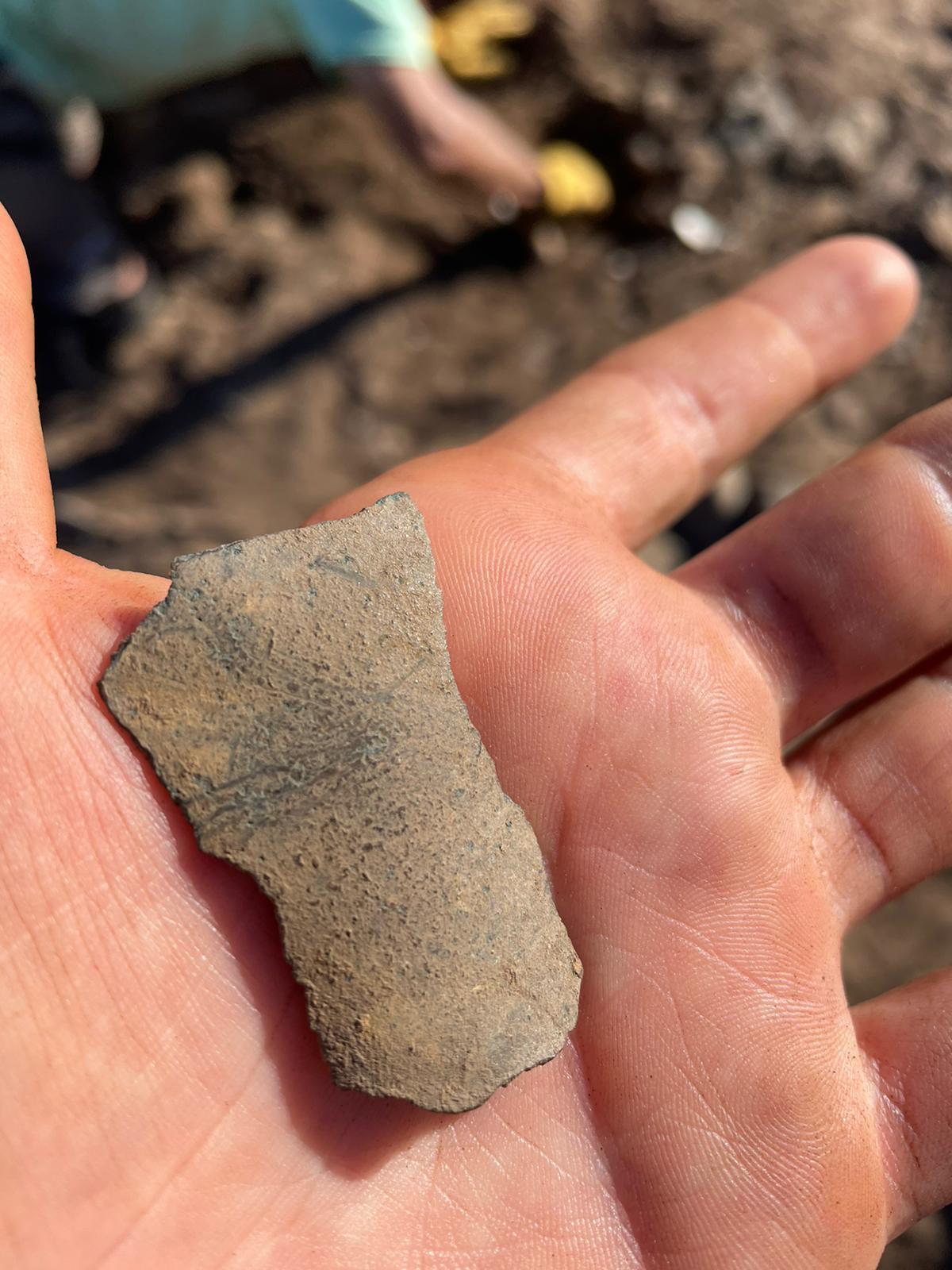
| Ceramic Building Material | 19 | 125 | (Year 2021) |
| Other (add to description) | 3 | 2 | Charcoal. (Year 2021) |
| Daub | 34 | 728 | (Year 2021) |
| Ferrous Object | 2 | 19 | (Year 2021) |
| Bone | 3 | 2 | Fish bone. (Year 2021) |
| Slag | 3 | 7 | (Year 2021) |
| Lead Object | 1 | 5 | (Year 2021) |
| Other (add to description) | 1 | 13 | Mortar. (Year 2021) |
| Shell | 669 | 2595 | (Year 2021) |
| Stone | 209 | 2249 | Quartz pebbles. DISCARDED. (Year 2021) |
| Stone | 1 | 23 | (Year 2021) |
Feature
- No records attached.
Site Photos
-
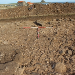
Photo: LDF_215465
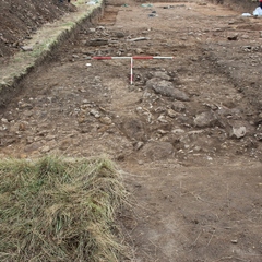
- S looking plan photo of rubble layer (2331) after the removal of overburden/plough soil layer (2304)
-
Photo: LDF_215469
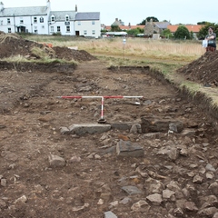
- N looking plan photo of rubble layer (2331) after the removal of overburden/plough soil layer (2304)
-
Photo: LDF_215856
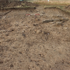
- N looking mid ex record shot of (2331) rubble layer after initial mattock and trowel. 2m scales
-
Photo: LDF_215858
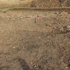
- E looking mid ex record shot of (2331) rubble layer after initial mattock and trowel. 2m scales
-
Photo: LDF_215859
- E looking mid ex record shot of (2331) rubble layer after initial mattock and trowel. 2m scales
-
Photo: LDF_215921
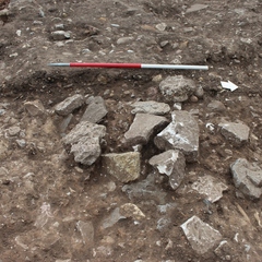
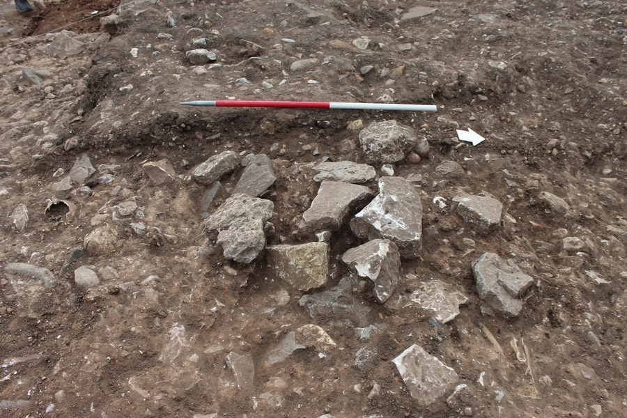
- W looking photo of concentrated patch of rubble in the central area of the northern extension of TR2 (W). Layer (2331). Possible part of lime kiln structure collapse. 1m scale
-
Photo: LDF_215922
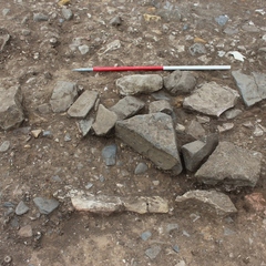
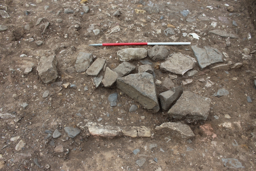
- N looking shot of area of rubble collapse within layer (2331) at Eastern area of TR2W extension. Possibly representing a partial collapse of the Eastern flue of the limekiln. 1m scale
Plan
-
Plan: LDF_49
- Post ex plan of trench 2 west. 1:50. Sheet 34 and 36. Drawn by Karen, David Hazel, Chris Swindels and Jill Supervised by DW
- Karen Moritz
- 23-9-2021
Record Details
- Not set
- Bill Balding 18-9-2021
- - - - -
- - -