Short Description:
Cut of a large Limekiln Pit F217
Issued to
Chris Swindells | 13/09/2019
Interpretation
-
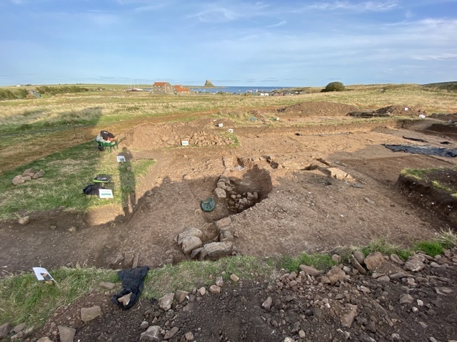
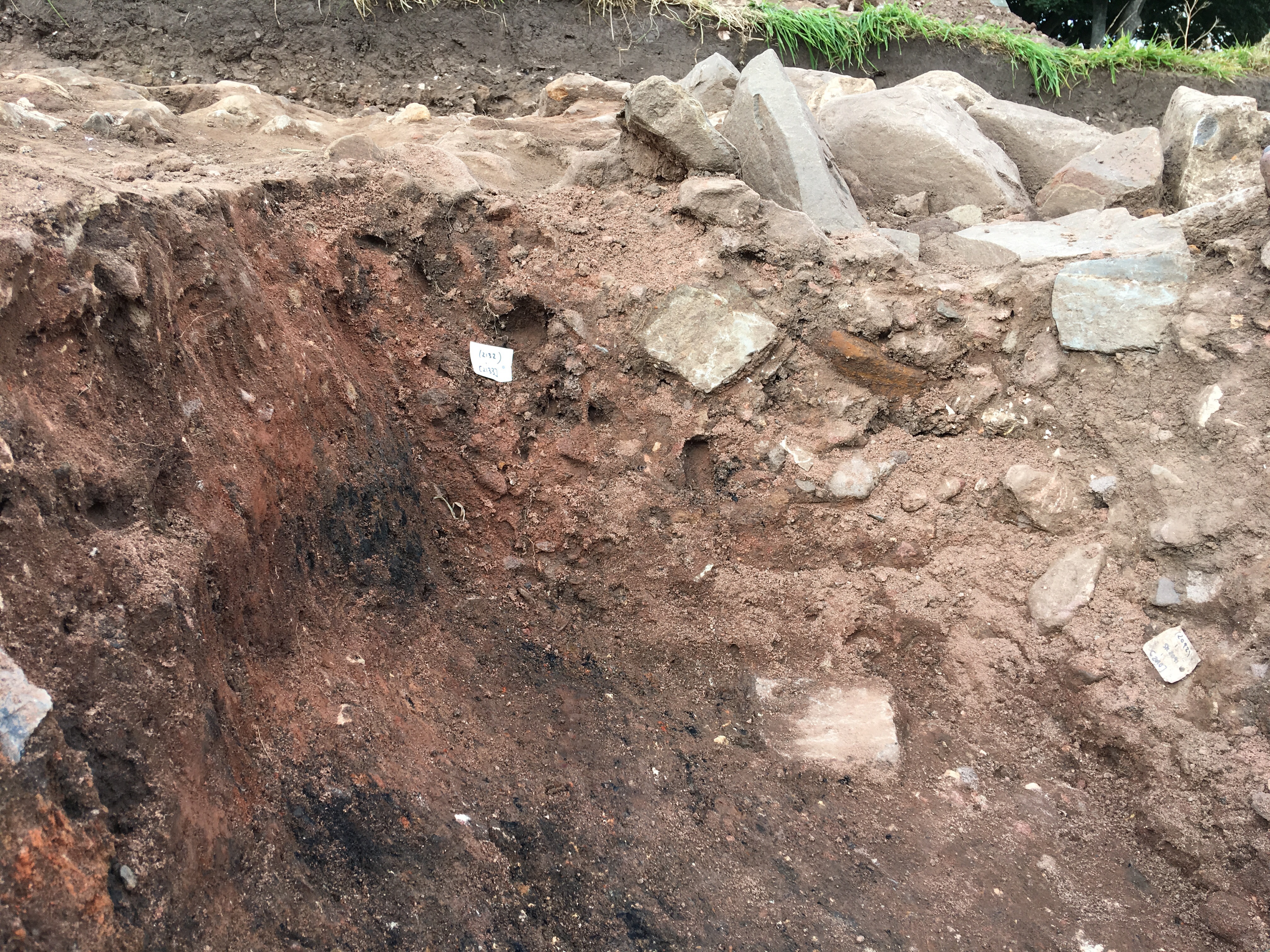
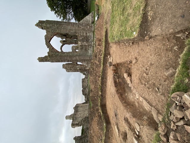
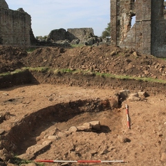
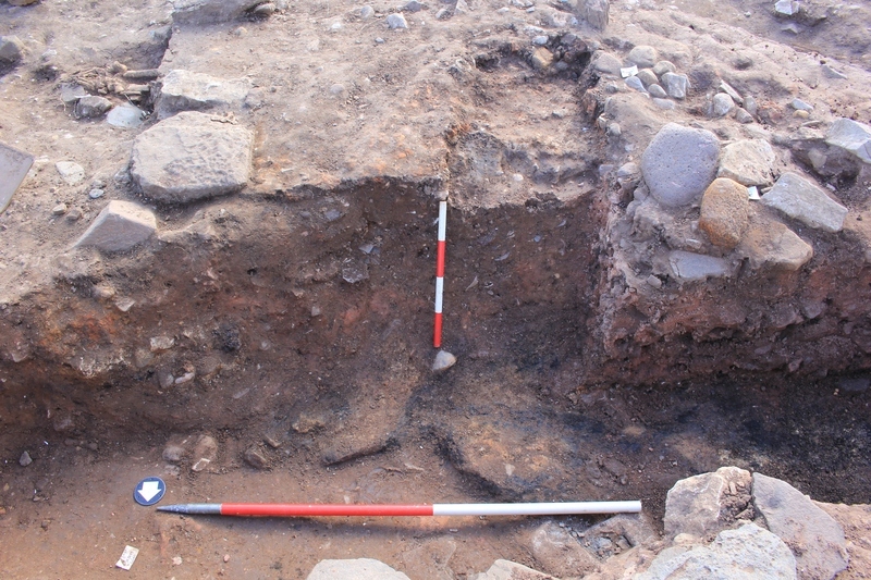
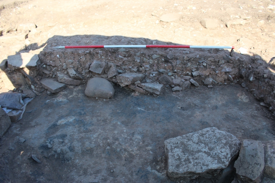
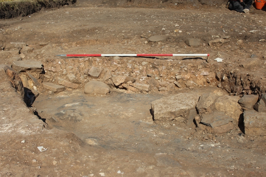
- First identified in 2019, the 2021 season revealed the full extent of this feature through the extension of TR2 (W) to the North and West. It measures approximately 8.50m to 9.50m in diameter and 0.55m in depth and has been identified as a limekiln likely contemporary with the construction of the Norman Priory which still stands in ruined form today. This dates its use to the late 11th century when the priory construction began. This was also confirmed through C14 dating. The base of the cut and the sides are extremely heat affected, with a layer of burning approximately 0.18m thick permeating through the sandy clay natural (2344). Whilst the base of the limekiln pit appears to be cut into the natural, archaeological features earlier than the pit do exist below it. A grave [2366] containing SK2368 was found upon excavation to be cut by the limekiln pit
-
- Ben Swain
- 29-9-2021
-
- The cut of a large circular/sub-circular feature (F217), upon excavation a series of layers of burning were exposed in the cut, indicating that this feature has been cut into various earlier layers of burning.
-
- Nat Jackson
- 1-10-2020
Sketch Photo
Stratigraphic Matrix
Equal To
No Linked Records
Description
- Sub-circular
- Length - 9.50m Width - 8.50m Depth - 0.55m
- Sharp
- Steep
- Sharp
- Flat
- Truncated by burials F219 and F220. The 2021 season revealed hints of truncation of some earlier features including some walls, however this needs further investigation in future seasons to characterise and confirm
- First identified in 2019, TR2 (W) was extended in 2021 to encompass the entirety of the feature
Finds
Feature
-
Feature: LDF_217
- Large Norman Limekiln pit in the northern area of TR2(W)
Site Photos
-
Photo: LDF_192670
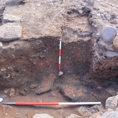
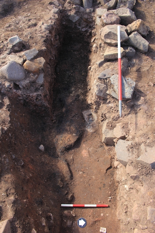
- Mid-ex of kiln structure. S facing. 1m horizontal scale, 0.4m vertical scale.
-
Photo: LDF_192675
- Mid-ex of kiln structure. W facing. 0.4m horizontal scale, 1m vertical scale.
-
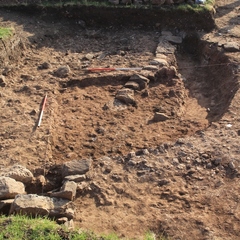
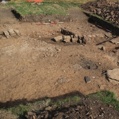
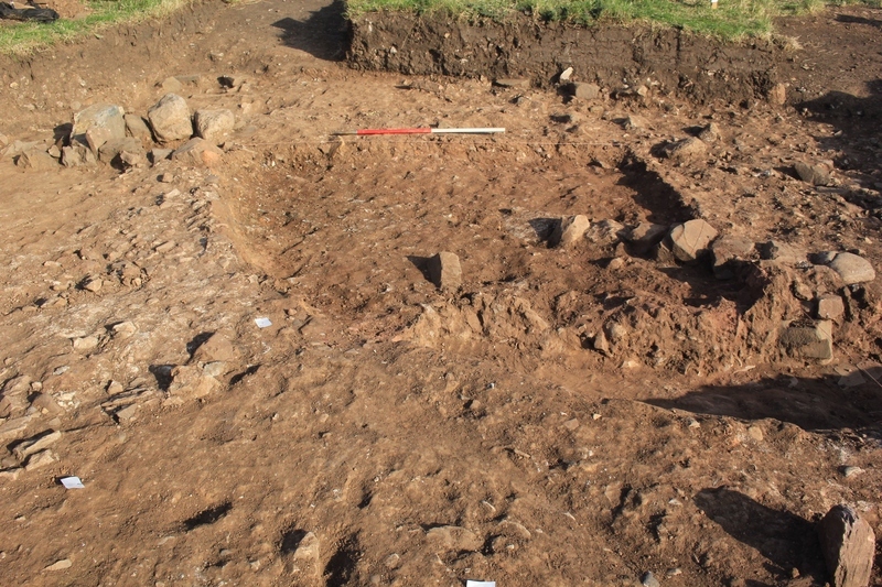
Photo: LDF_201400
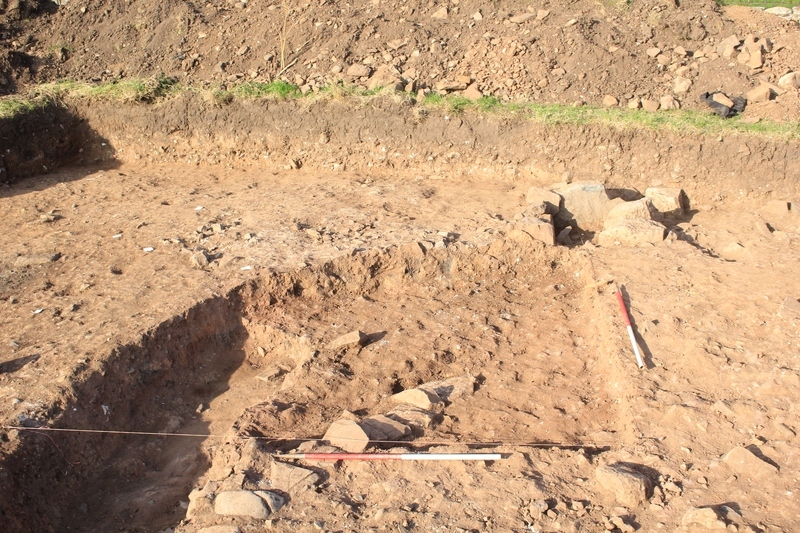
- SW looking photo of F217 mid excavation
-
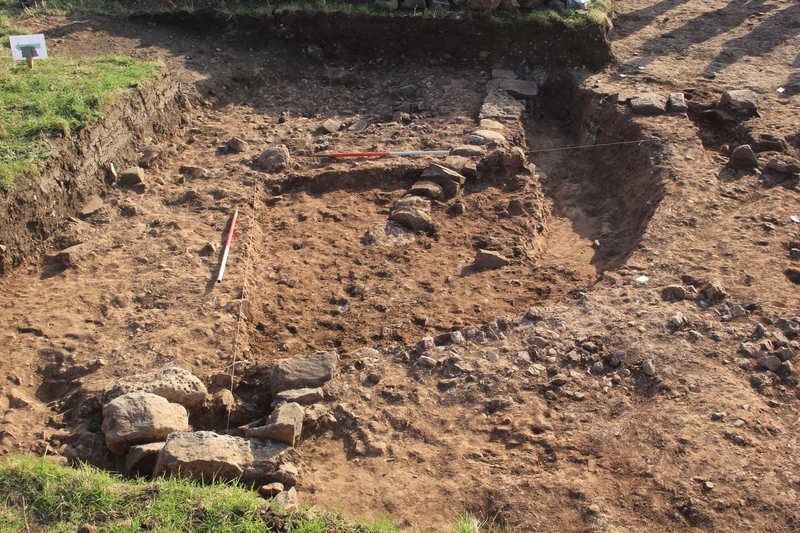
Photo: LDF_201403
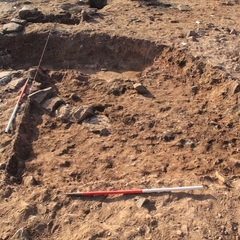
- S looking photo of F217 mid excavation
-
Photo: LDF_201404
- E looking photo of F217 mid excavation
-
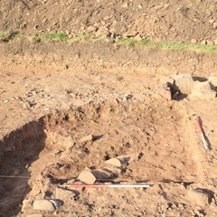
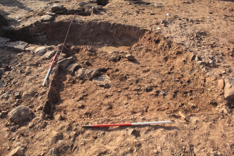
Photo: LDF_201410
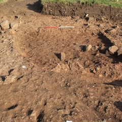
- N looking photo of F217 mid excavation
-
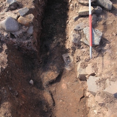
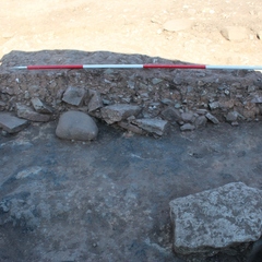
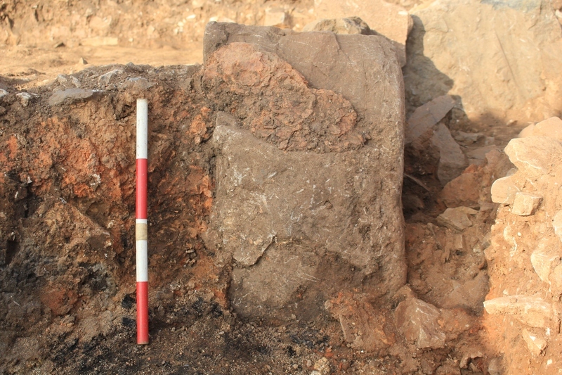
Photo: LDF_201893
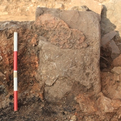
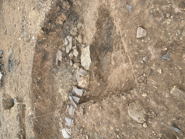
- W looking photo of burnt material on the cut of F217 and attached to stone in part of a possible flue (2157)
-
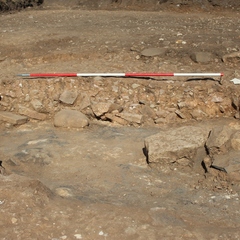
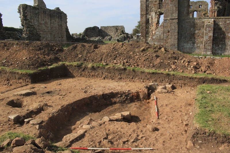
Photo: LDF_201933
- SW looking photo of quadrant excavated into F217 and wall F248
-
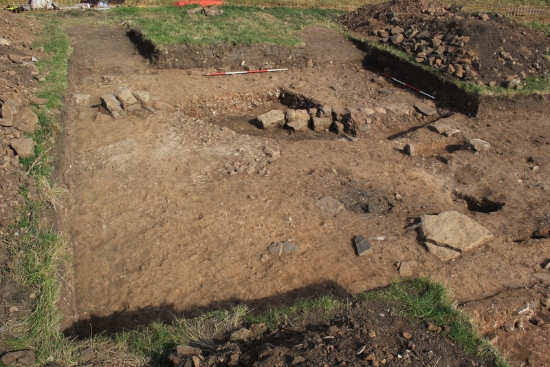
Photo: LDF_201942
- N looking photo of NW extension of trench 2 at end of 2020 season
-
Photo: LDF_215871
- N looking shot of S facing section through limekiln pit F217 [2133] (2350) (2165). 2m scale
-
Photo: LDF_215872
- N looking shot of S facing section through limekiln pit F217 [2133] (2350) (2165). 2m scale
Plan
-
Plan: LDF_49
- Post ex plan of trench 2 west. 1:50. Sheet 34 and 36. Drawn by Karen, David Hazel, Chris Swindels and Jill Supervised by DW
- Karen Moritz
- 23-9-2021
Record Details
- Not set
- Chris Swindells 13-9-2019
- - - - -
- - -