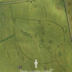
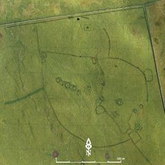
- Victoria Camp
- Victoria camp (VC) is centred around SD842652 and is situated in a field to the east of Victoria Caveat an altitude of around 440m OAD in an area know as Langcliffe Scar Local Nature ReserveSmall excavations have been undertaken in the 1970's by Alan King and a subastantioal survey was completed by Roger Martlew in 2007 and 2010. Alan King excavated a depression which was 4m long and contained elements of barytes and malachite in its base. This evidence drew conclusions of a bowl furnace, used for copper smelting (King 1970). There are twelve associated hut circles, two over 10m in diameter none of which produced any datable finds. A partially excavated burial mound contained bronze studs with iron nails and were probably part of a shield (Martlew 2007). Due to the nature of the overlying vegetation any non-invasive archaeological investigation is difficult, but recommendations for further investigation and excavation were suggested (Martlew 2007). While there are few obvious areas of active erosion, the shallow depth of soil in many locations increases the vulnerability of the archaeological evidence. Despite some investigations in the past, interpretation of the area cannot proceed very far at present without entering the realms of speculation. Martlew, R. D. 2007. Langcliffe Scar Local Nature Reserve Archaeological Survey 2007. Yorkshire Dales Landscape Research Trust King, A. 1970b. Early Pennine Settlement: A Field Study. Clapham. Dalesman Publishing Co Ltd
3-D Models
Plan
-
Plan: UTU_7
- Plan of Victoria Camp Drawn by Martlew R 2007 Langcliffe Scar Local Nature Reserve Archaeological Survey, Yorkshire Dales Landscape Partnership Trust.
- Admin Admin
- 5-1-2017
Section
- No records attached.
Features
-
Feature: UTU_08
- Bank 04
Contexts
-
Context: UTU_4001
- Brendon Wilkins 20-8-2016

