Basic Information
- Cave 01 - Ben Scar Cave
Contexts
-
Context: UTU_5001
- Settle Bank
- Hugh Fiske
- 18-8-2016
Narrative
-
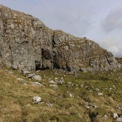
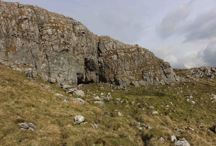
- Shallow cave with low, indistinct curvilinear stony bank around flat area in front. 384366E - 464380N - 455M This was allocated CV01 in Martlew R. 2007. Langcliffe Scar Local Nature Reserve. Archaeological Survey. Yorkshire Dales Landscape Research Trust.
-
- Hugh Fiske
- 18-8-2016
Dating Narrative
-
- Situated on Langcliffe Scar, close to Victoria Cave and situated within the Langcliffe Local Nature Reserve in a field south of Attermire Cave and south of Victoria Camp, Ben Scar Cave was investigated by an aerial and topographic survey by Roger Martlew in 2007. It is part of a site of special scientific interest that is assigned to be general Iron Age/Romano British, although there might also have been earlier phases of use of the area. This solution cave lies within an area of limestone upland on an altitude of 455m and commands extensive views of the Ribble Valley to the south west and Pendle Hill to the south – and on a clear day, the Lake District – due to its prime south facing setting. Ben Scar is a shallow cave – 4.5m wide – and has a distinct natural overhang in the entrance area that is surrounded by an enclosure. The land is a ‘basin and pavement topography’ and there is a high likelihood of the cave being utilised in the Romano-British period and/or Iron Age for habitation or stock control (Martlew, R. D. 2007. Langcliffe Scar Local Nature Reserve Archaeological Survey 2007. Yorkshire Dales Landscape Research Trust).
-
- Johanna Ungemach
- 9-9-2016
Matrix
-
- [not set]
- [not set]