Basic Information
- Southern extent of the curtain wall enclosing the site
Contexts
-
Context: MDC_1008
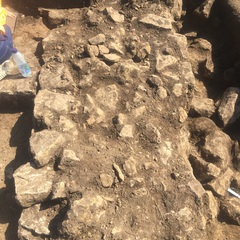
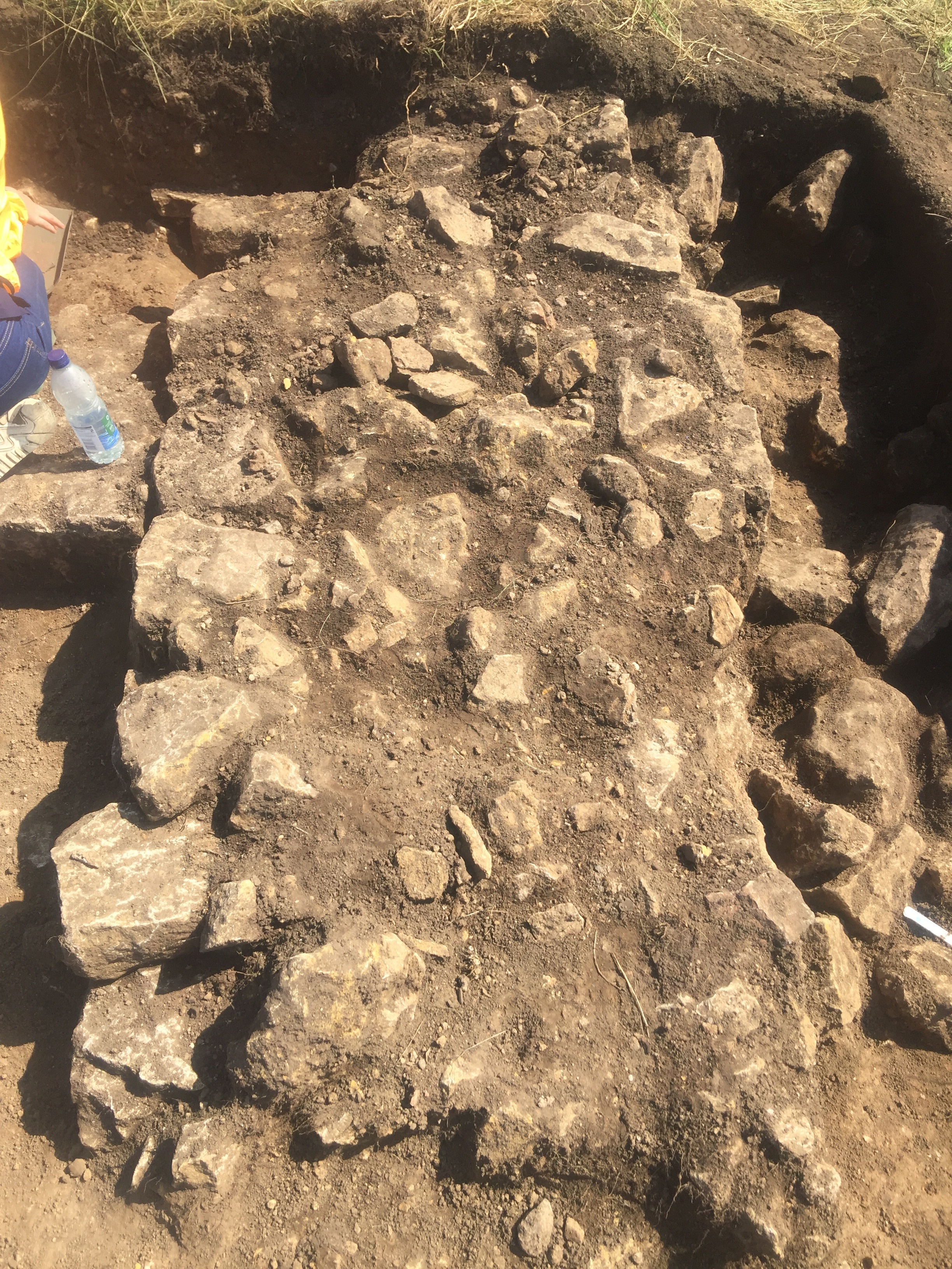
- Southern extent of the east-west aligned wall curtain wall. E-W aligned wall of coursed square flat faced limestone and lime mortar. Max size of blocks 30x15x23cm.
- Rachael Vallis
- 16-8-2019
Narrative
-
- A coursed wall constructed of faced limestone blocks forming the southern extent of the curtain wall enclosing the manorial site. Four courses of masonry remained extant and the wall measured c. 1.05 m in width. The substantial wall was slumping downslope to the south, and a layer of mixed rubble (1009) had accumulated adjacent to the wall in this direction. This wall defined the southern extent of the manorial site along the edge of the escarpment of the bedrock promontory. The wall was used to form the southern wall of an east–west aligned structure, also defined by walls (1002) and (1003).
-
- Chris Scott
- 28-8-2019
-
- The wall continued eastwards and westwards beyond the limits of excavation and based on correlation with the geophysical survey results it survived at least 10m long. Wall F15 and Wall F16 were similarly constructed, thus suggesting that they were broadly contemporary in age. However, it appears unlikely that they were originally been part of the same structure and instead were only later remodelled and integrated to form a single structure. Wall F15 was wider and more substantial than F16, and it appeared likely to have been originally constructed as the southern outer curtain wall of the Bishop’s Place. Wall F16 in contrast was narrower and was associated with a door opening suggesting that it was part of a separate building.
-
- Indie Jago
- 16-10-2020
Dating Narrative
-
- A terminus anti quem of AD 1150-1300 for wall was provided by a single potsherd of splash glazed jug recovered from beneath the wall in buried subsoil (1010) which overlay the natural geology.
-
- Indie Jago
- 16-10-2020