Basic Information
- Large building defined by walls (2004) and (2008)
Contexts
-
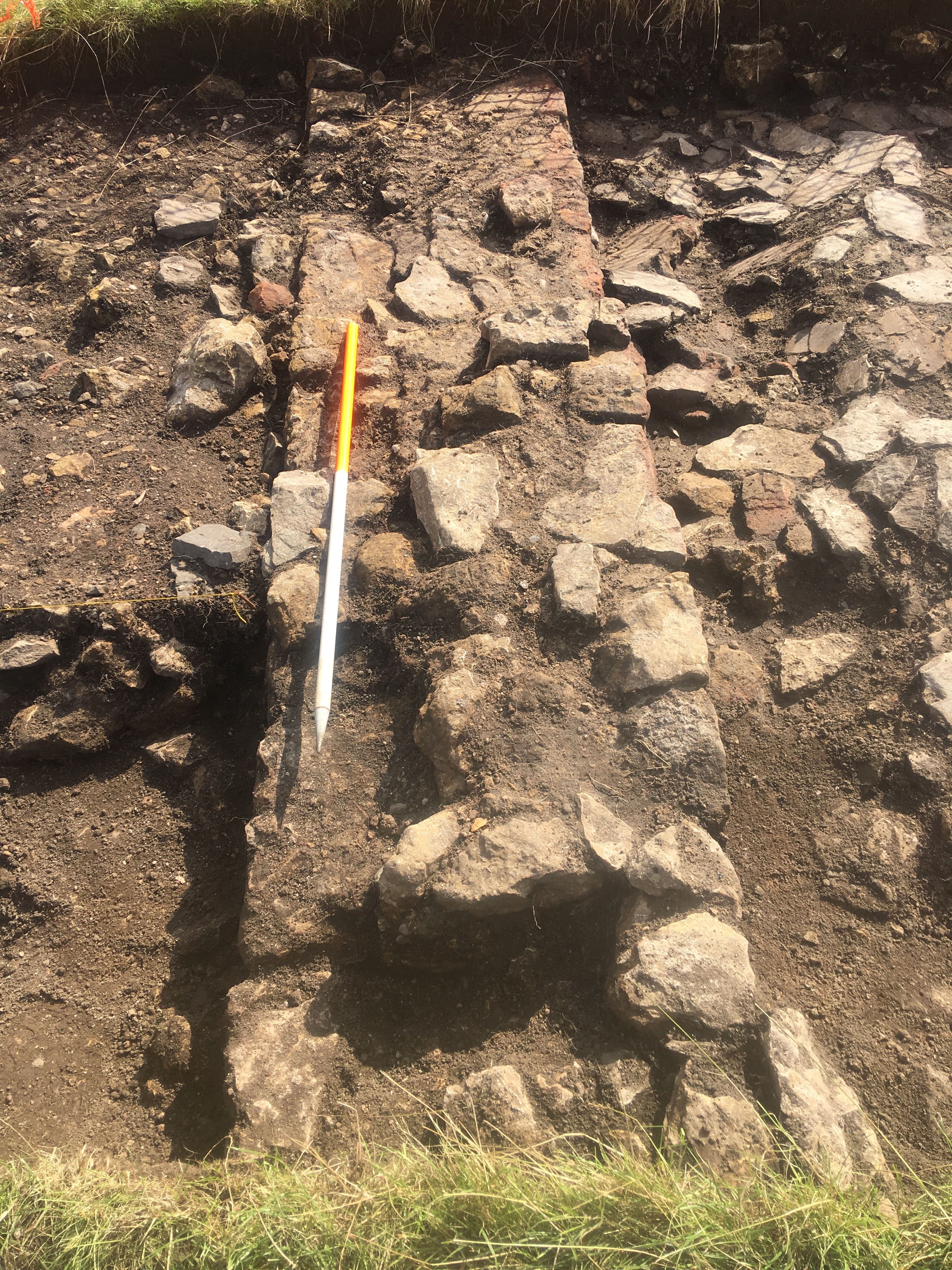
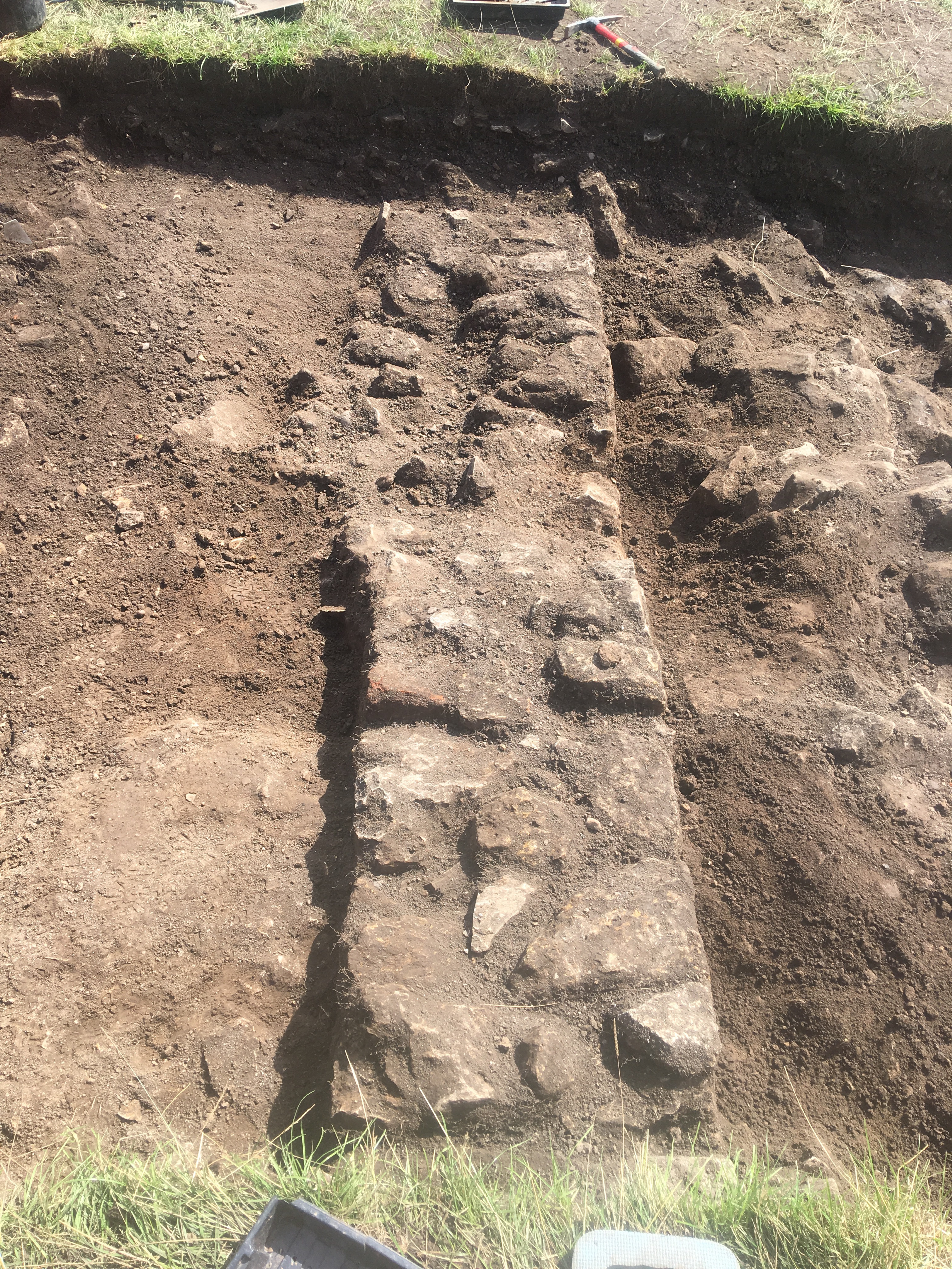
Context: MDC_2004
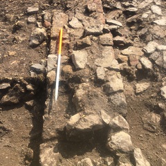
- North-south aligned wall running across Trench 2. N-S aligned. Regularly coursed linear wall of limestone blocks and fragments (av. 40x25x13cm). Internal face faces W, external to E. Seven courses extant bonded with yellow lime mortar. External faces of stones are well finished with visible tooling.
- Jodie Hannis
- 12-8-2019
-
Context: MDC_2008
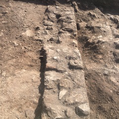
- East/West aligned wall. Regularly coursed linear wall of limestone blocks and fragments. Internal face S, external to N. Courses slope in line with natural contour of ground. Bonded with yellow lime mortar.
- Pandora Thoresby
- 15-8-2019
-
Context: MDC_2015
- Clay foundation deposit beneath wall 2004. Very firm green brown clay.
- Ben Moore
- 22-8-2019
-
Context: MDC_2016
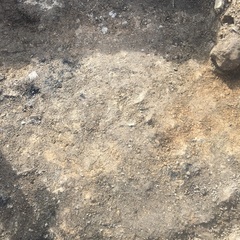
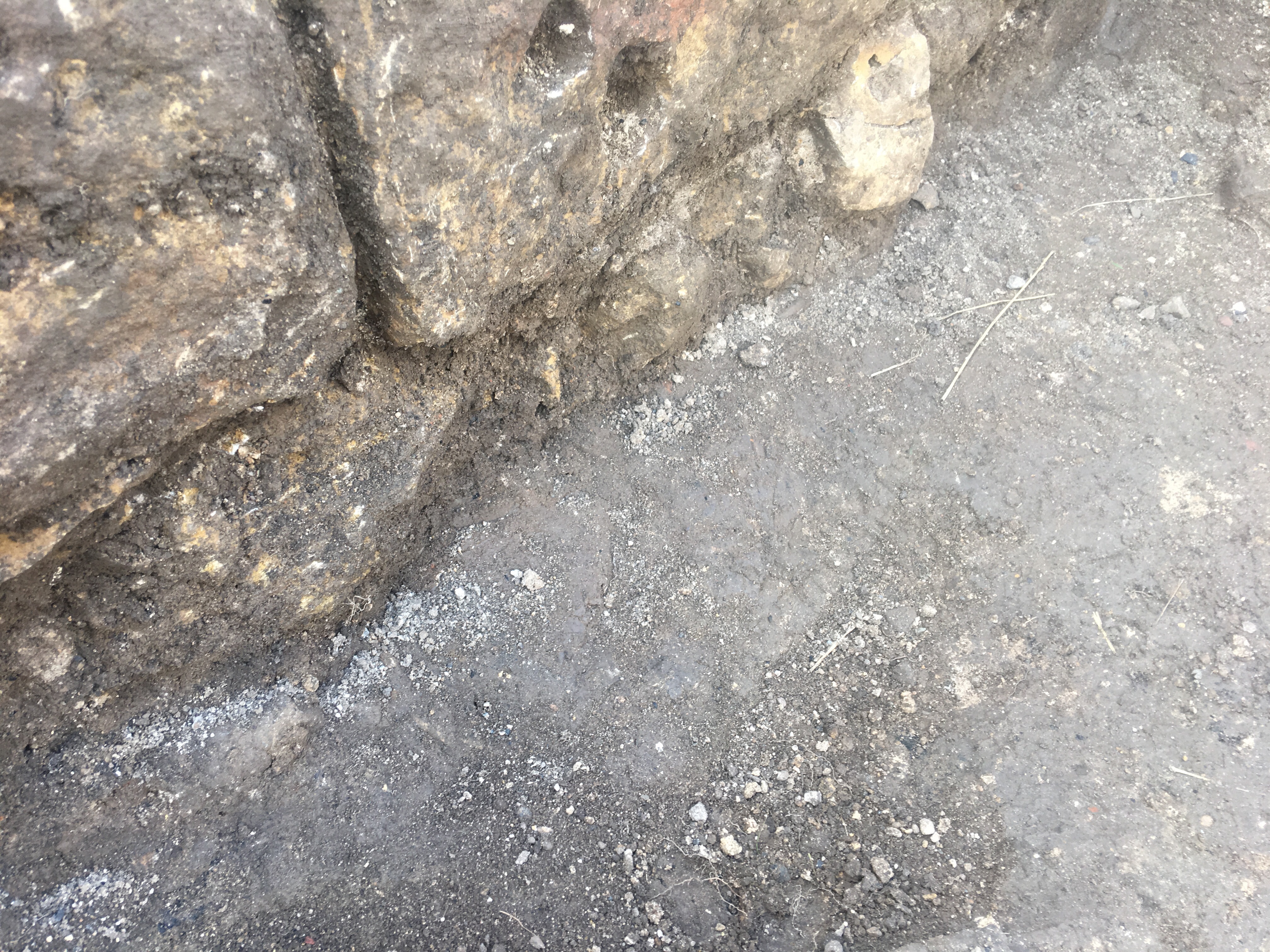
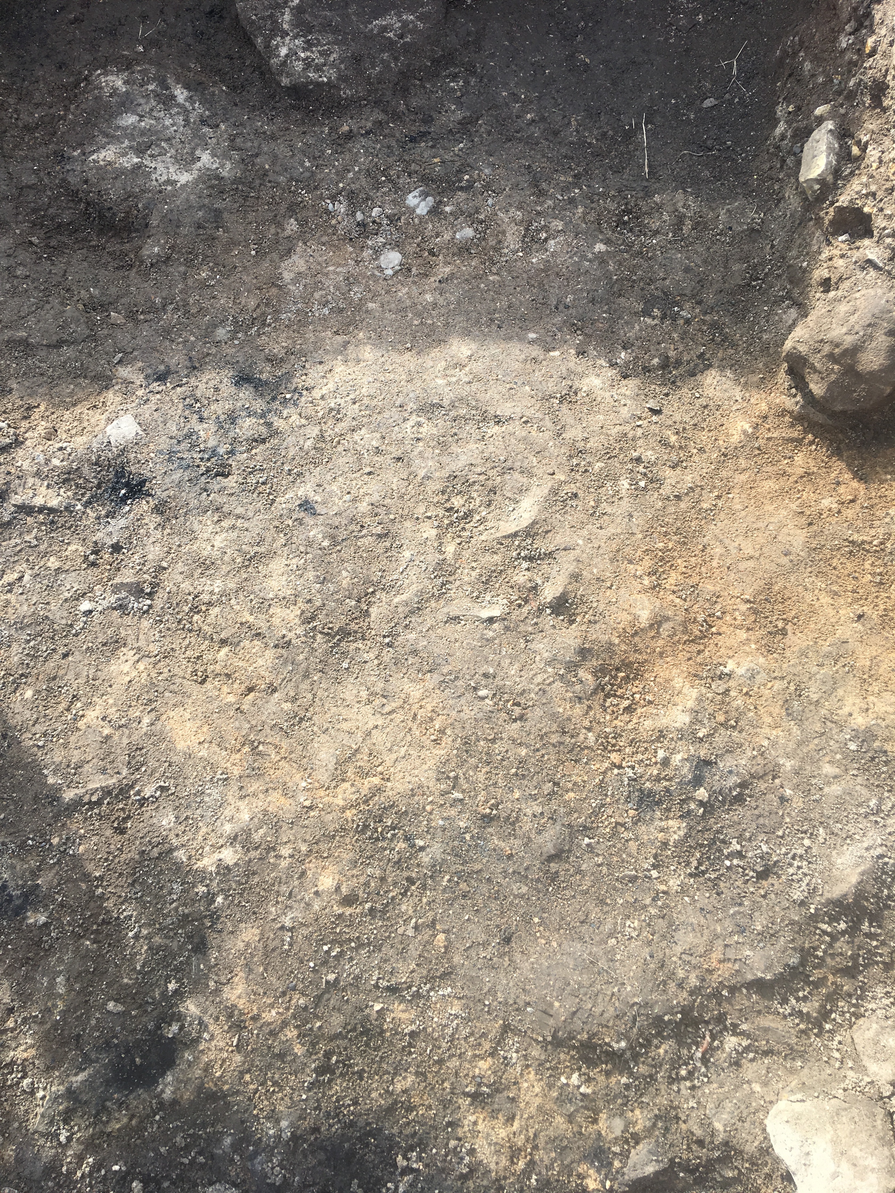
- Lens of material within the floor. Loose, beige, sandy clayey silt with 50% mortar and charcoal <10%
- Ben Moore
- 22-8-2019
-
Context: MDC_2018
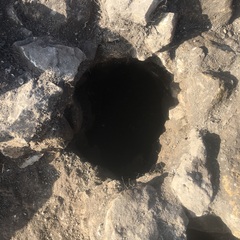
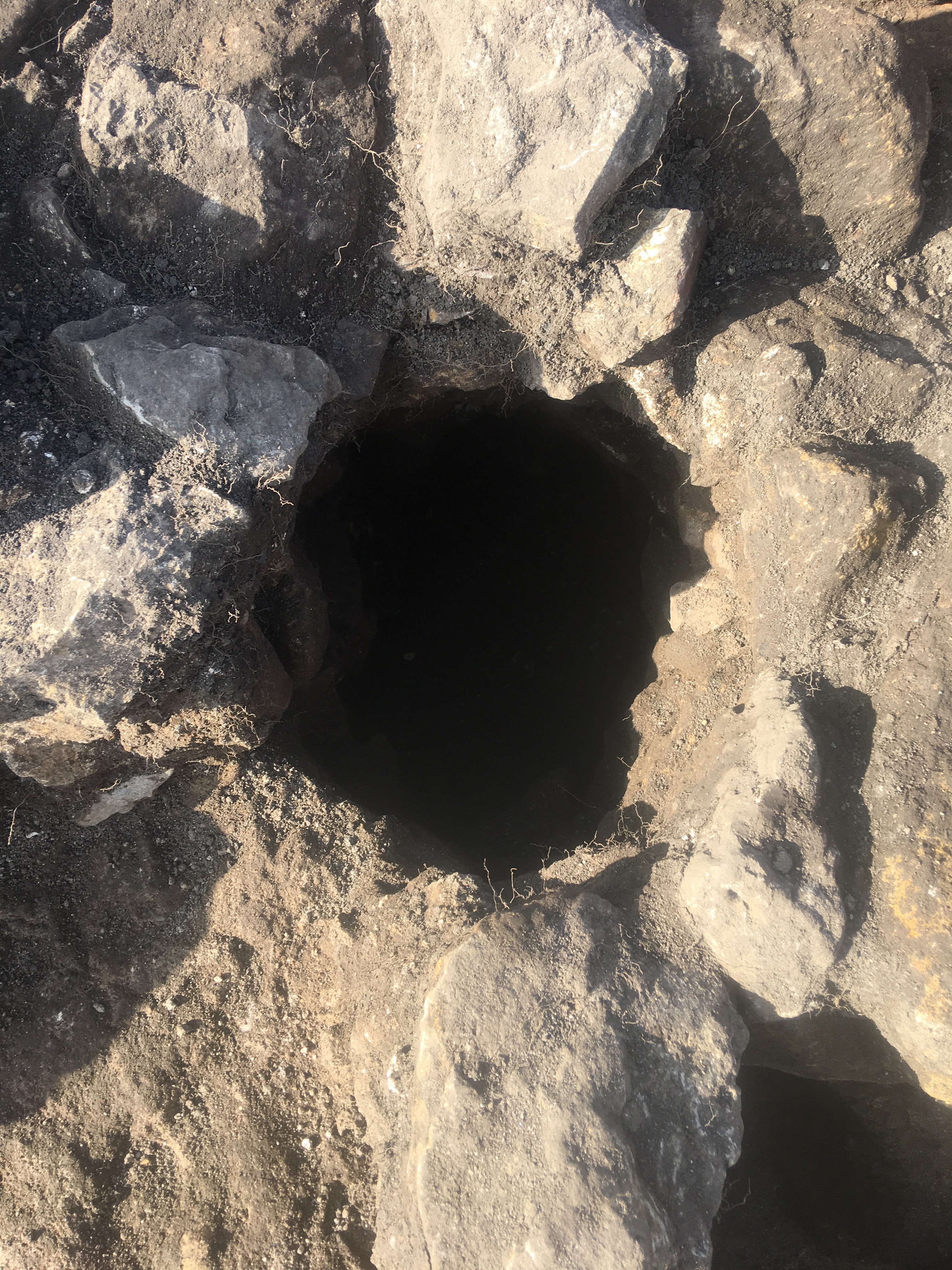
- Inclined tube within walls 2004 & 2008. Unfinished subangular limestone blocks, constructed to form a tube within walls (2004) and (2008). Inclined slightly towards south.
- Ben Moore
- 22-8-2019
-
Context: MDC_2019
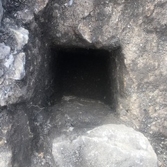
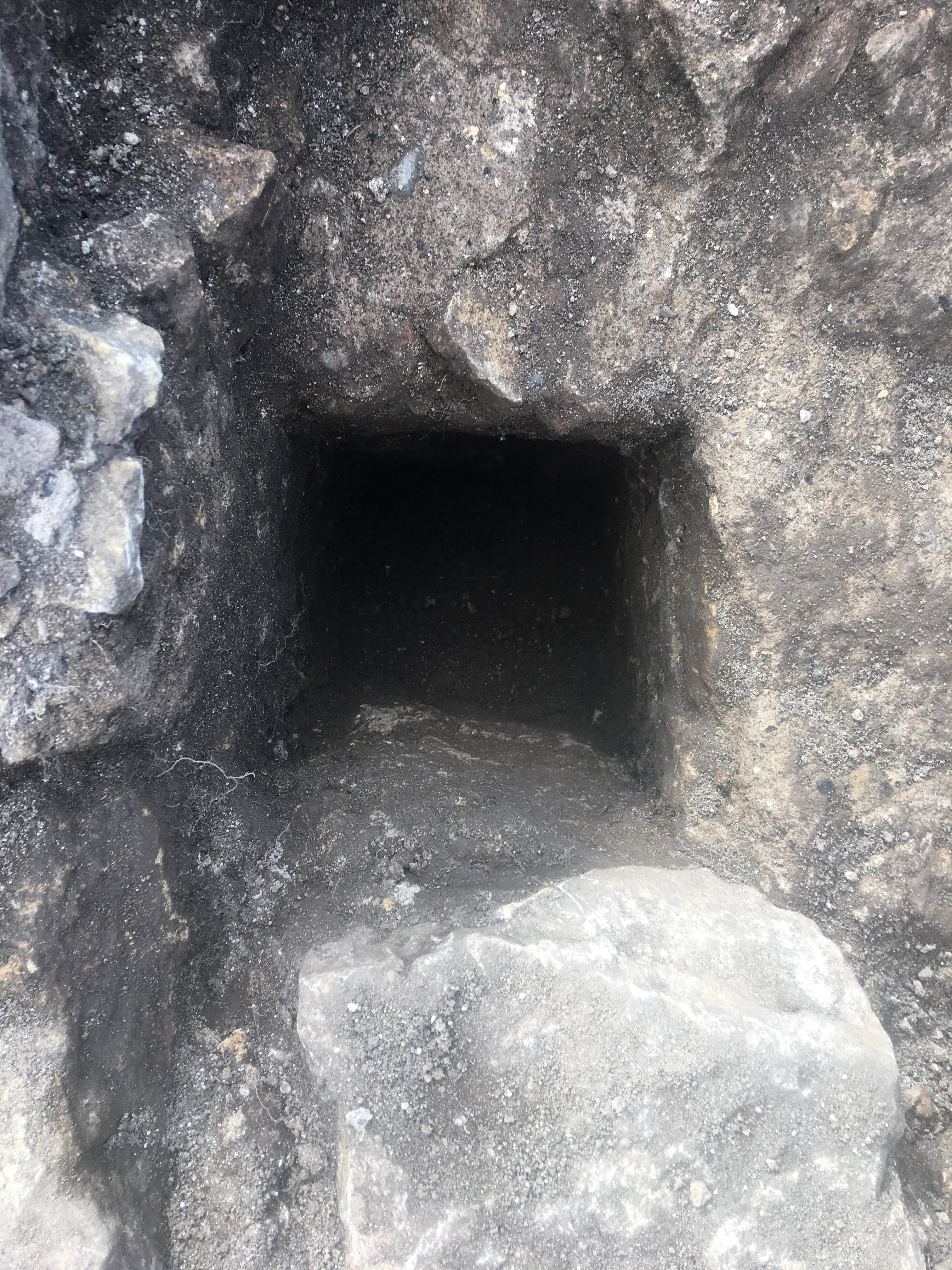
- Squared post/timber receptacle within wall 2004. Possibly faced rectangular limestone blocks, coursed and constructed to form a rectangular slot in wall (2004). Not fully excavated so full depth unknown.
- Ben Moore
- 22-8-2019
Narrative
-
- A large building orientated along an east to west alignment defined associated with N-S aligned wall (2004) and E-W aligned wall (2008). N-S aligned wall (2004) was likely an interior wall of building as supported by a very small patch of wall plaster on the wall and comparison with the geophysical data. Initially a dense spread of roof tiles (2005) immediately west of the wall (2004), was suggested to have been place to form a surface. However, it was later considered that the spread represented a collapse of the roof post-abandonment of the building. Beneath the tile spread was a compacted surface (2006) formed of rounded pebbles pressed into a clayish silt. Spreads of mortar and charcoal were observed across this layer. It is possible that layer (2006) was a sub-floor upon which a laid floor surface once existed (possibly evidenced by the mortar spreads observed) but this remains open to speculation. E-W aligned wall (2008) formed the northern wall of building F1. It was built of the same aligned as earlier structure F3, which may have represented the reuse of the basal coarses of the wall as foundations. At the intersection between walls (2004) and (2008) were square-spaced sockets, likely serving to hold upright timbers, (2018 and 2019). Exact phasing of the walls construction remained unclear, although they were likely broadly contemporary in age.
-
- Chris Scott
- Josh Hogue
- 27-8-2019
Dating Narrative
-
- The interior of building F1 – in the southeast corner of the trench – was associated with remnants of a floor surface and associated debris F6. Local wares (types 1, 5 and 7; including SF27) and Tees Valley ware (type B) potsherds recovered from this floor surface indicated a probable date range of AD1250-1350. An architectural fragment of reticulated tracery (SF26) was recovered consistent with a 14th century AD for building F1.
-
- Indie Jago
- 16-10-2020