- Claustral Precinct
Photos
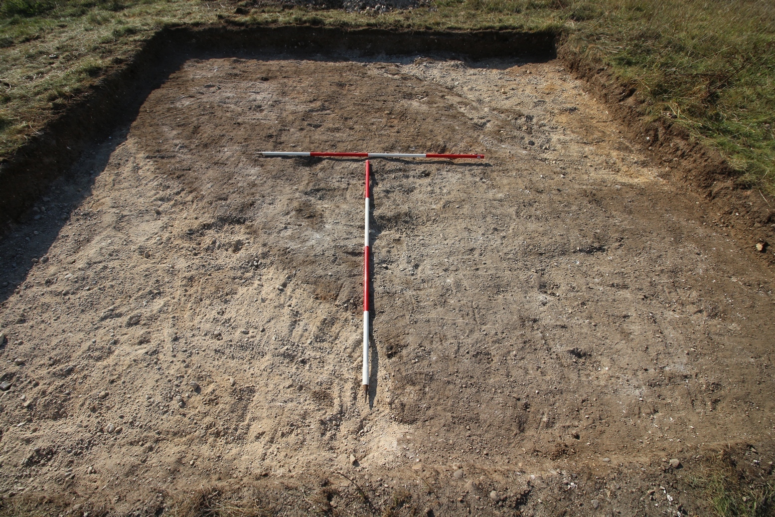


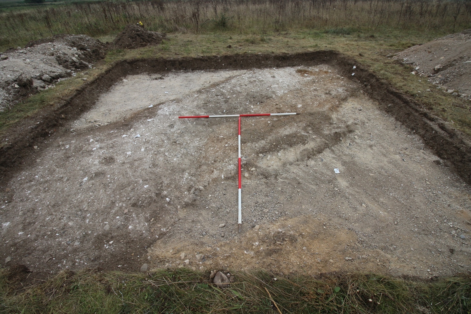
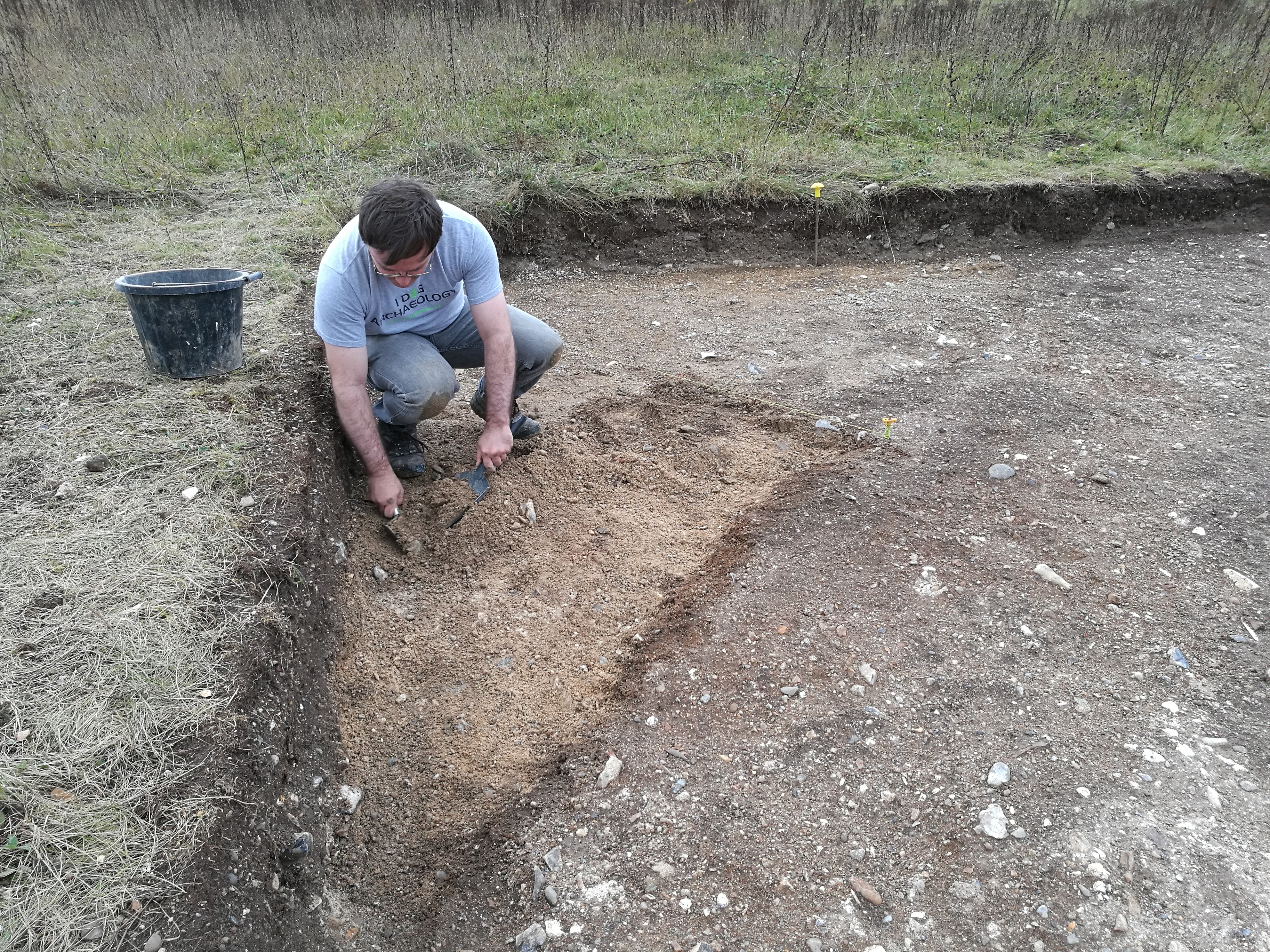

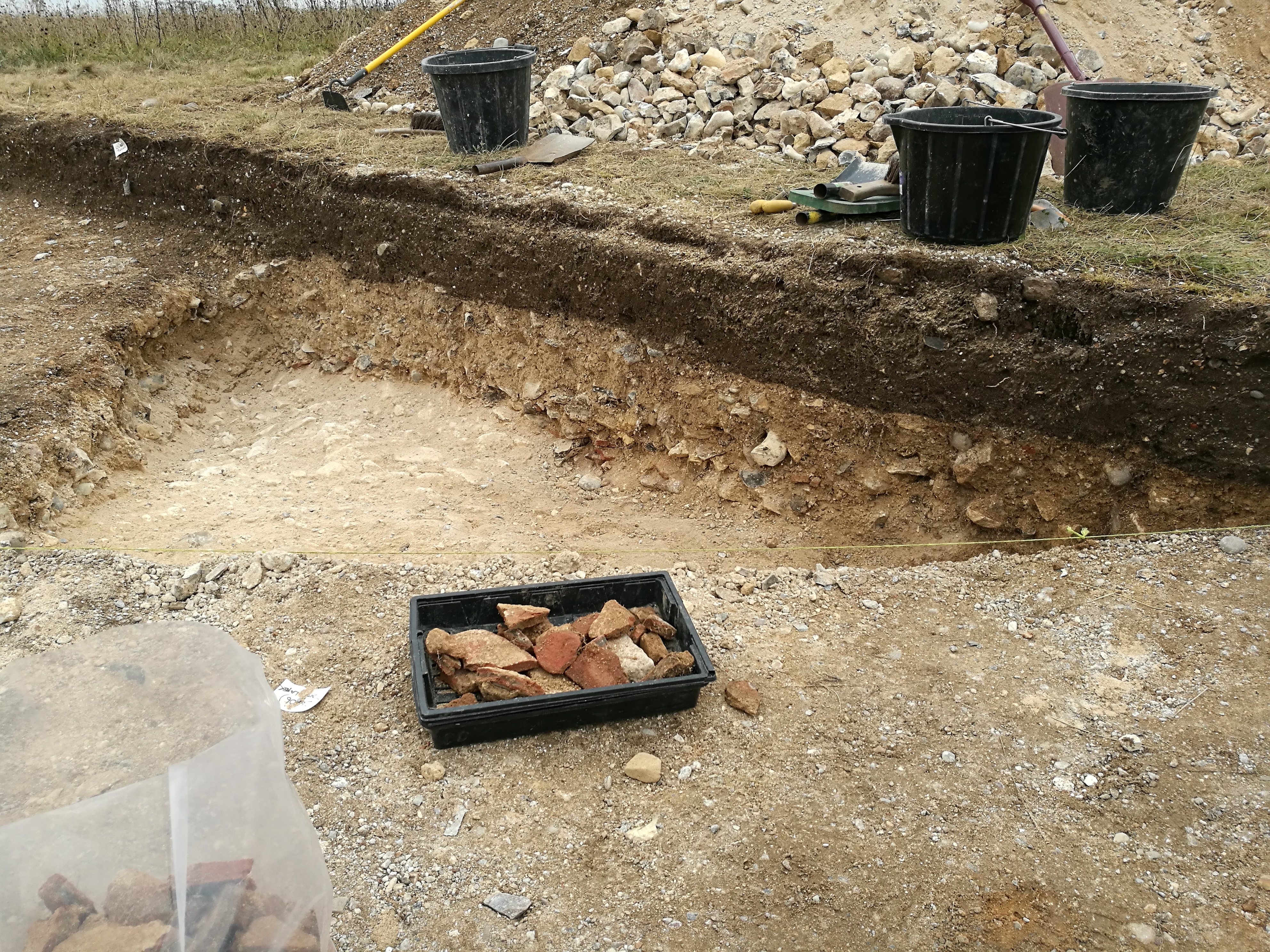


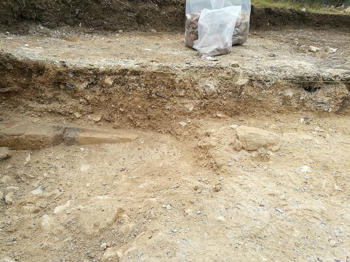
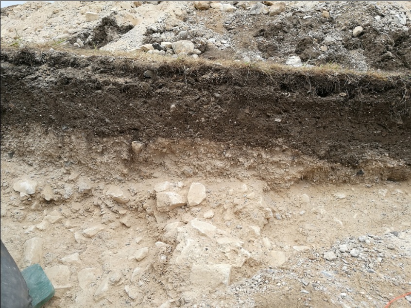
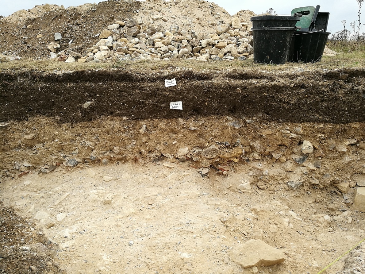
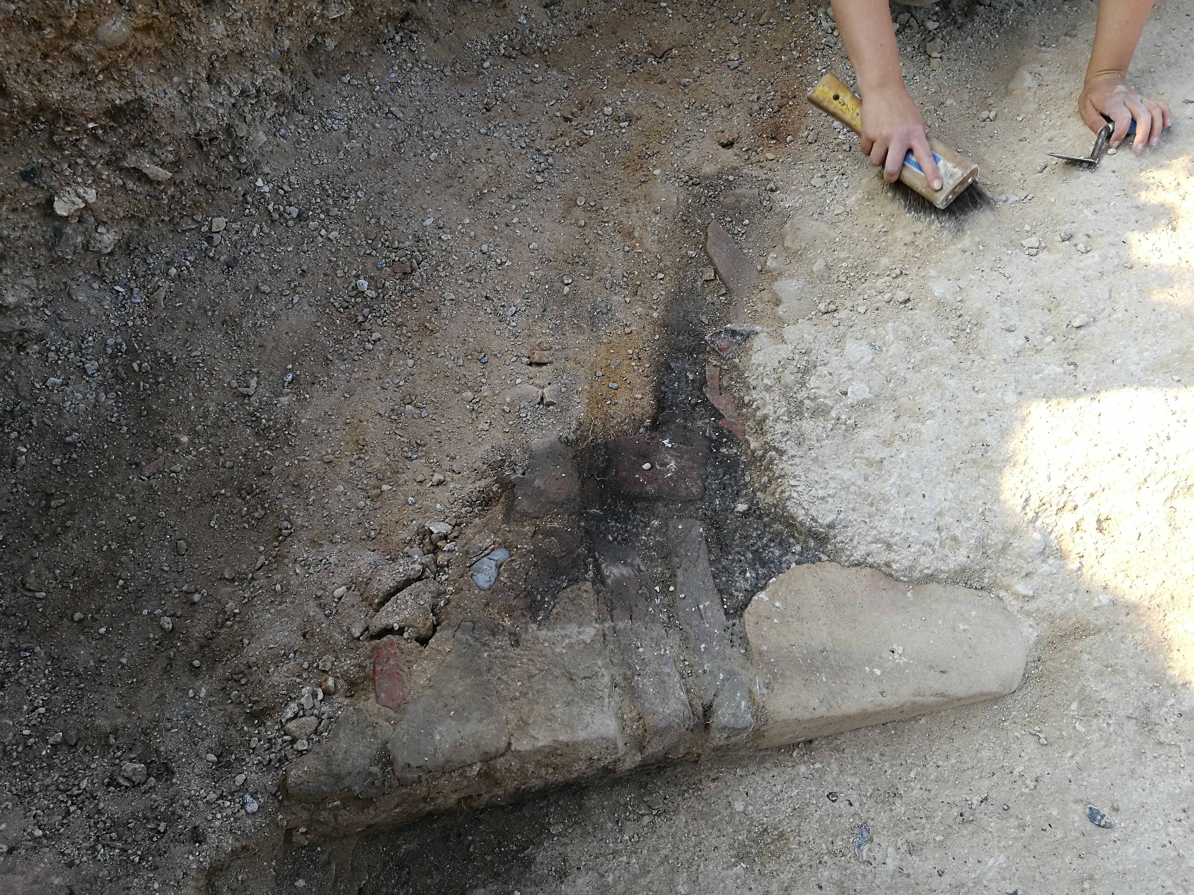
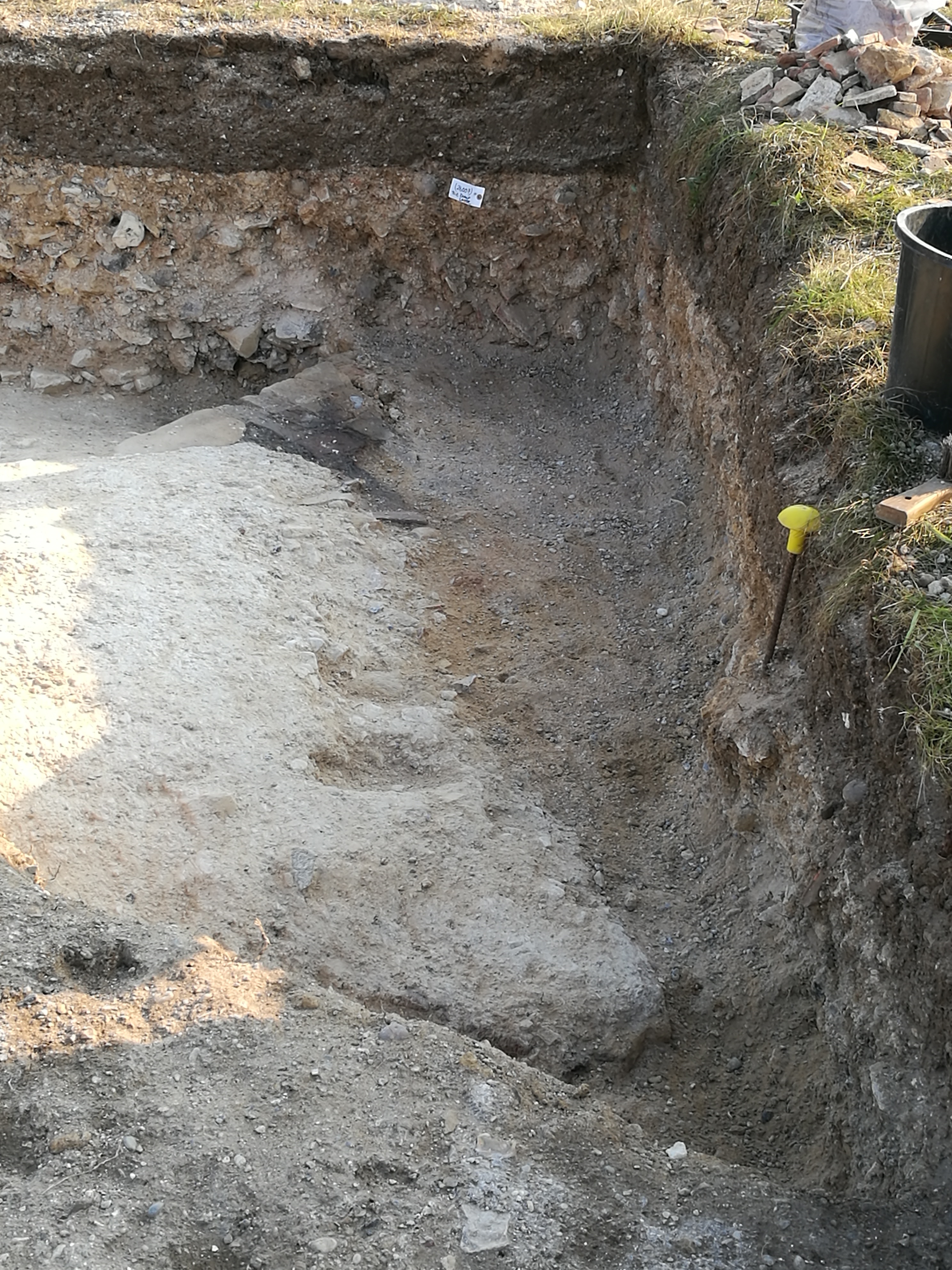
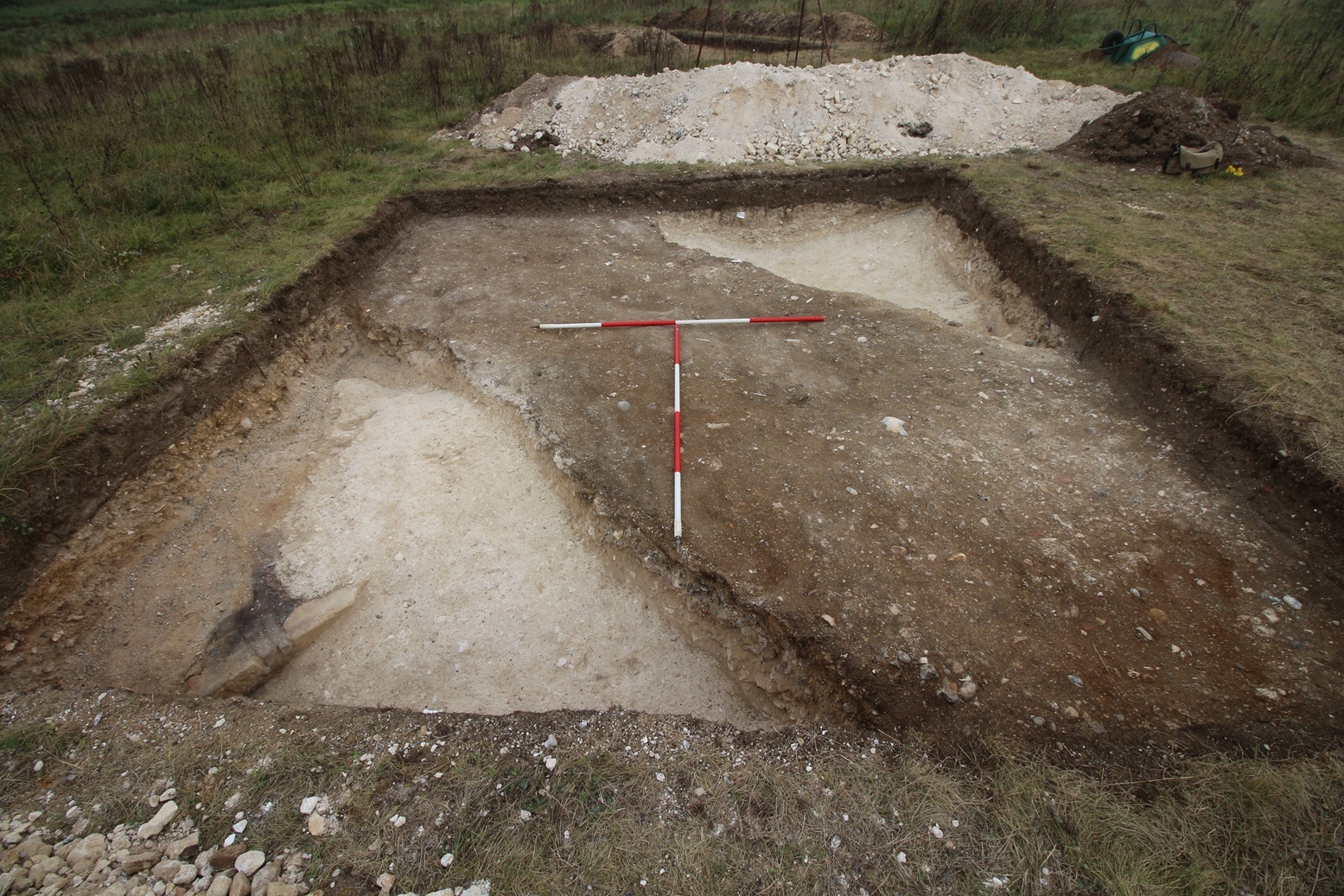

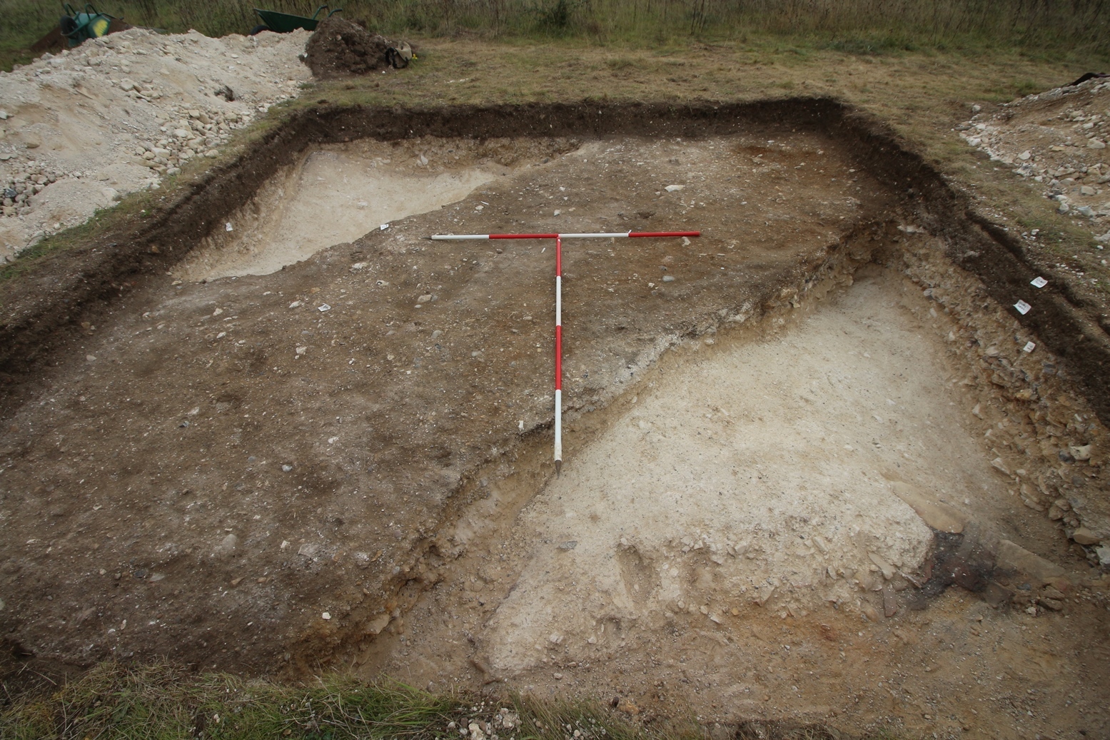

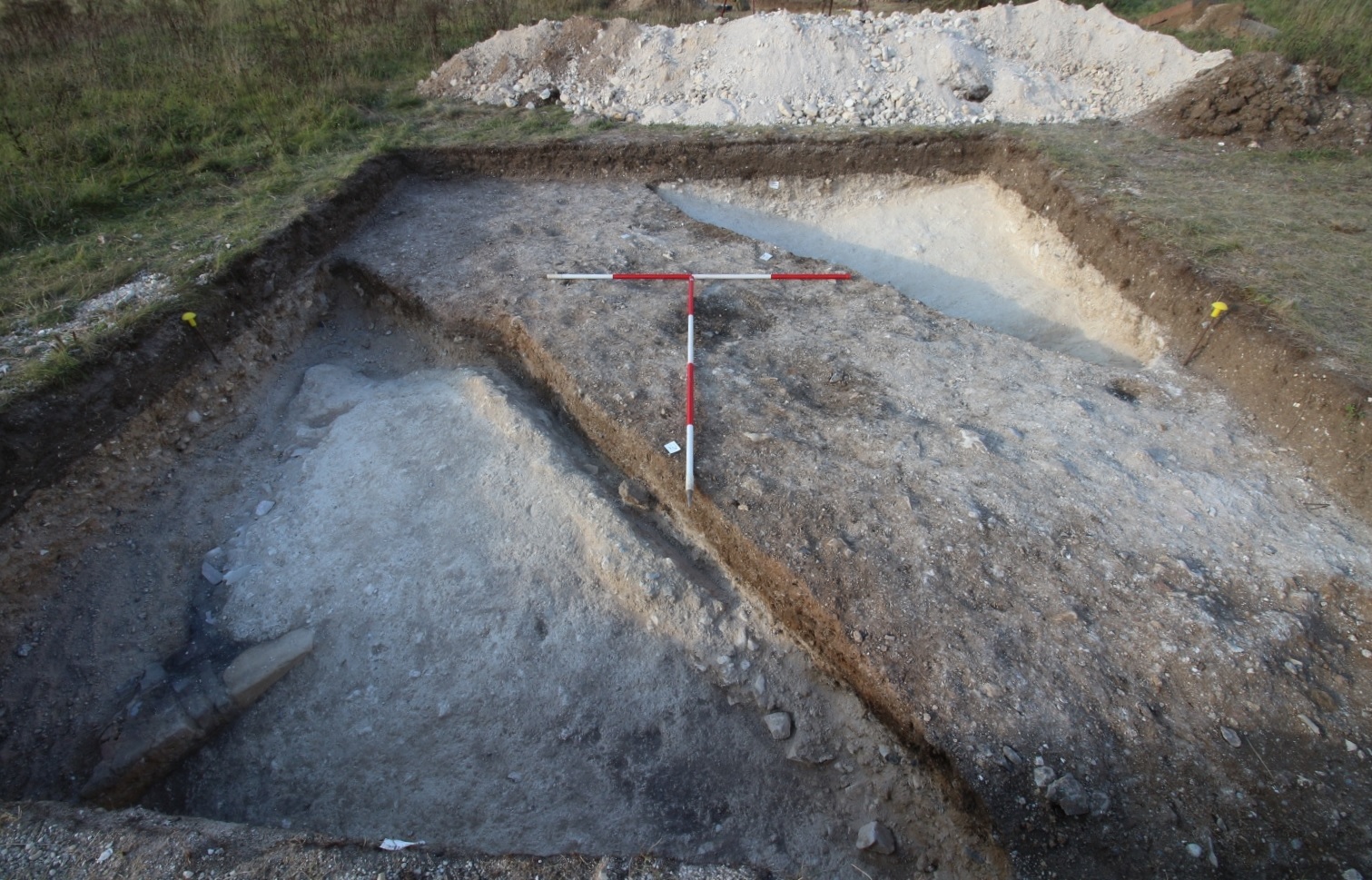
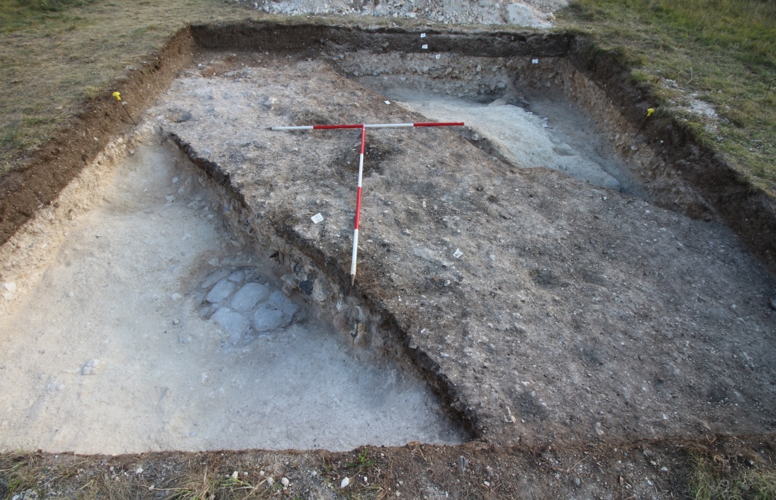

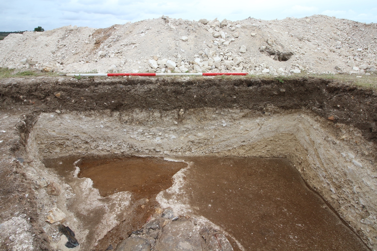

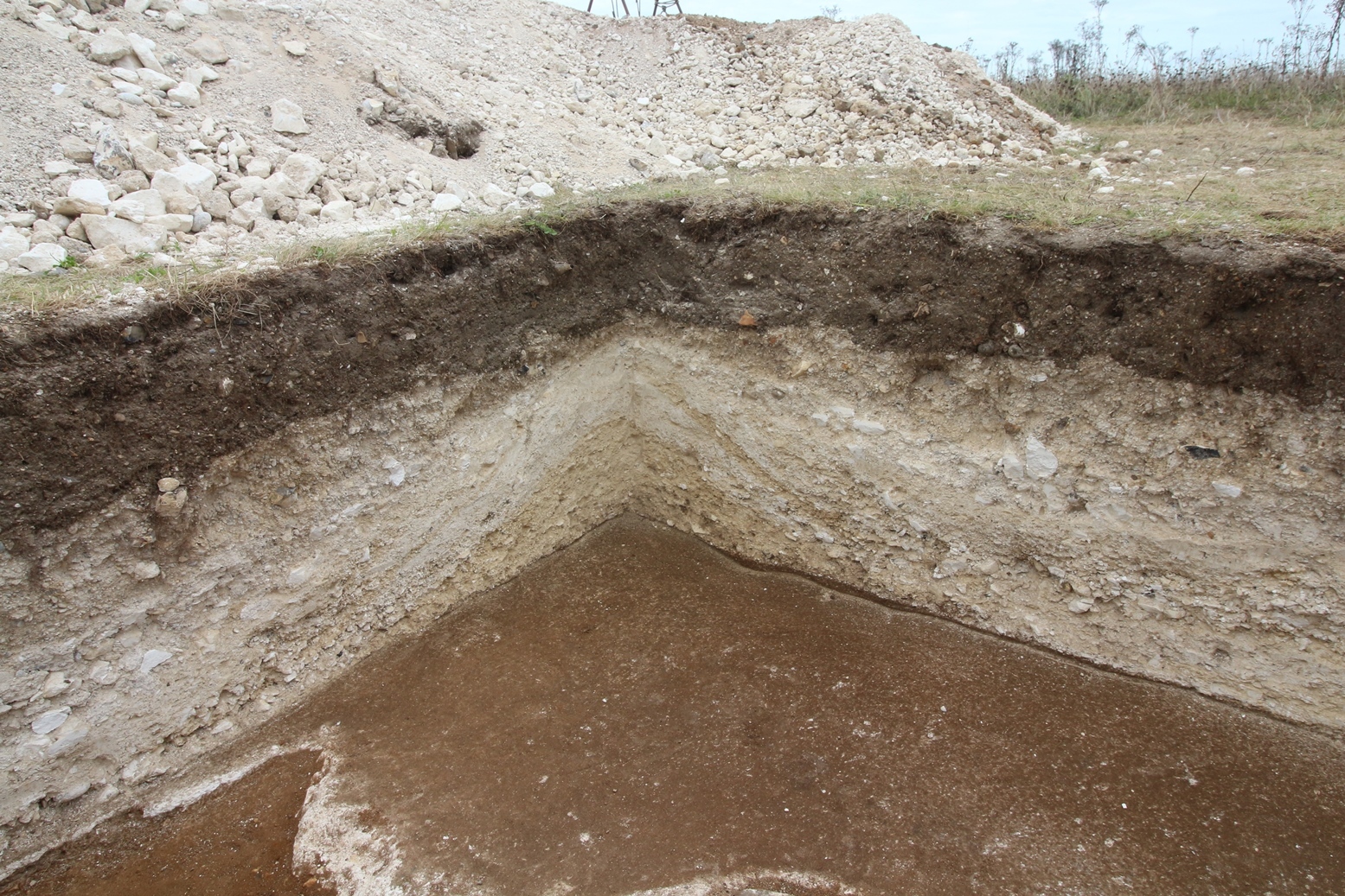
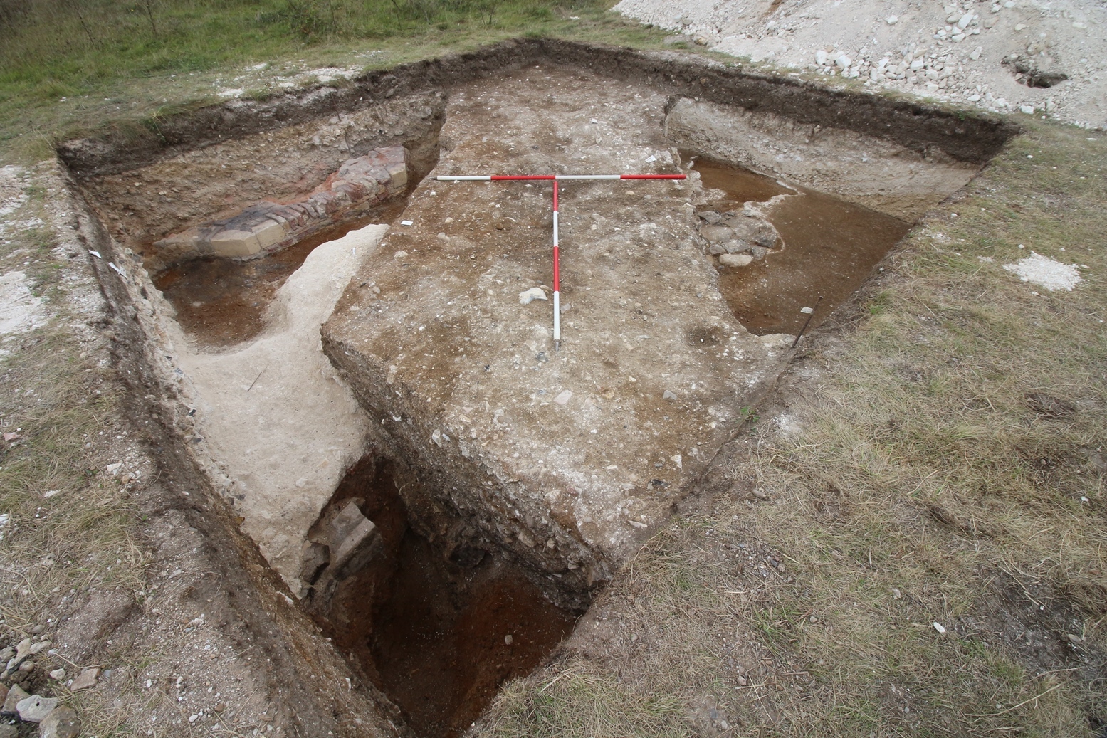
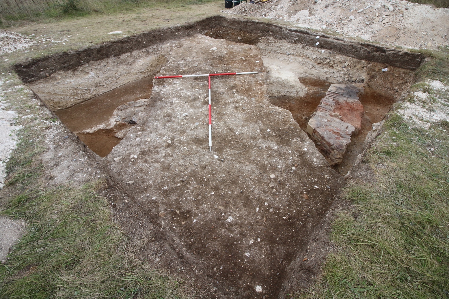

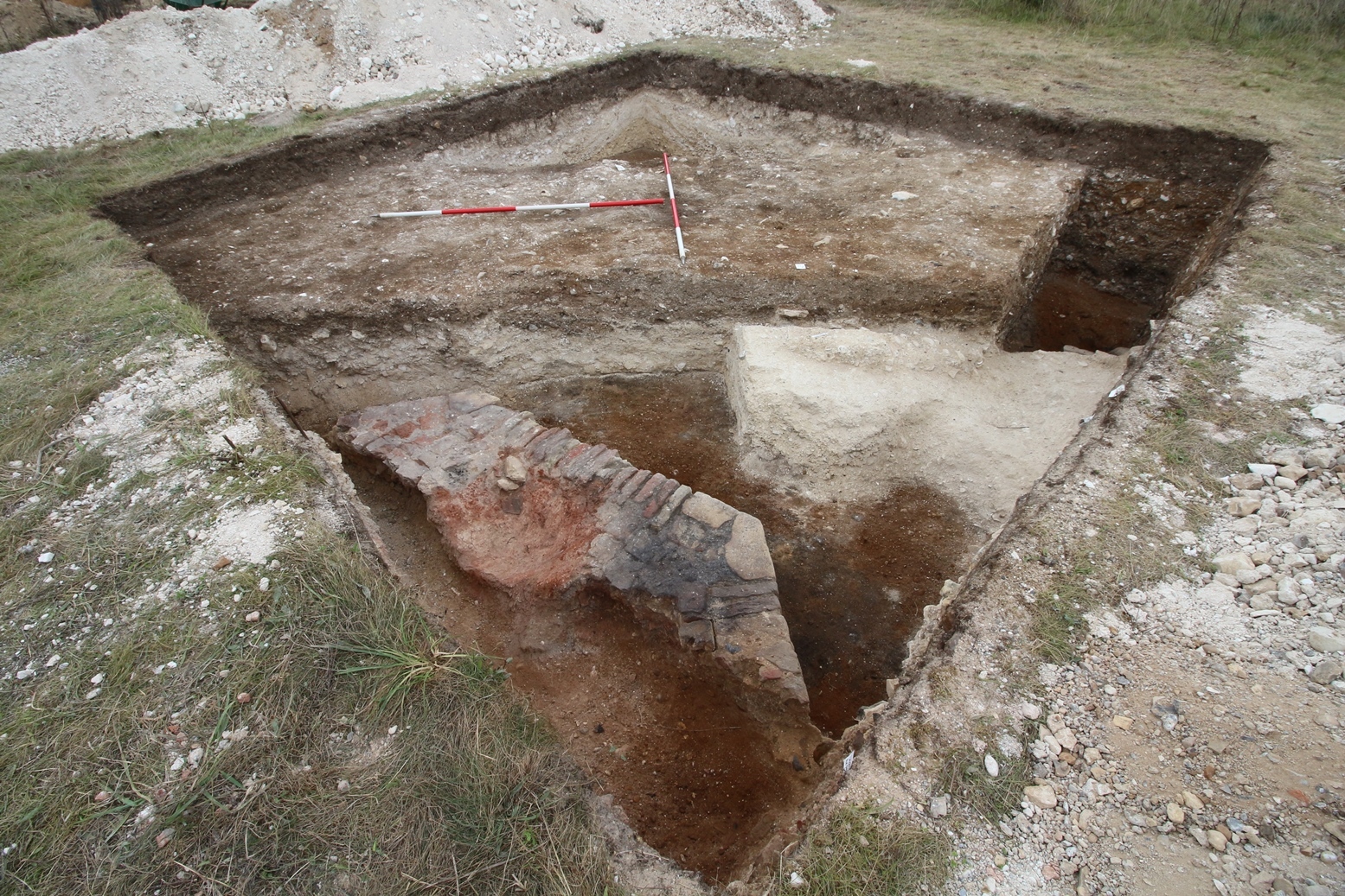

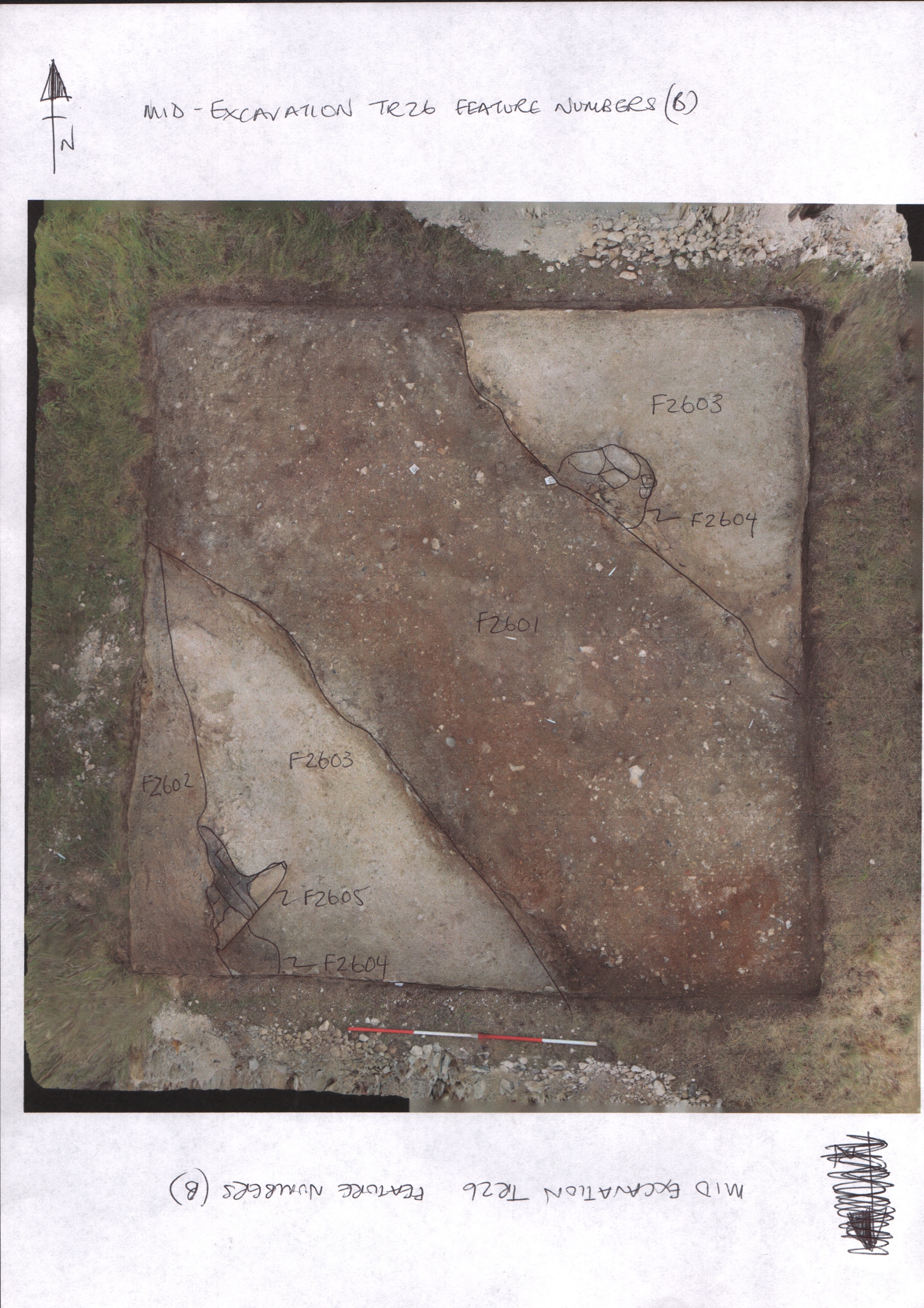
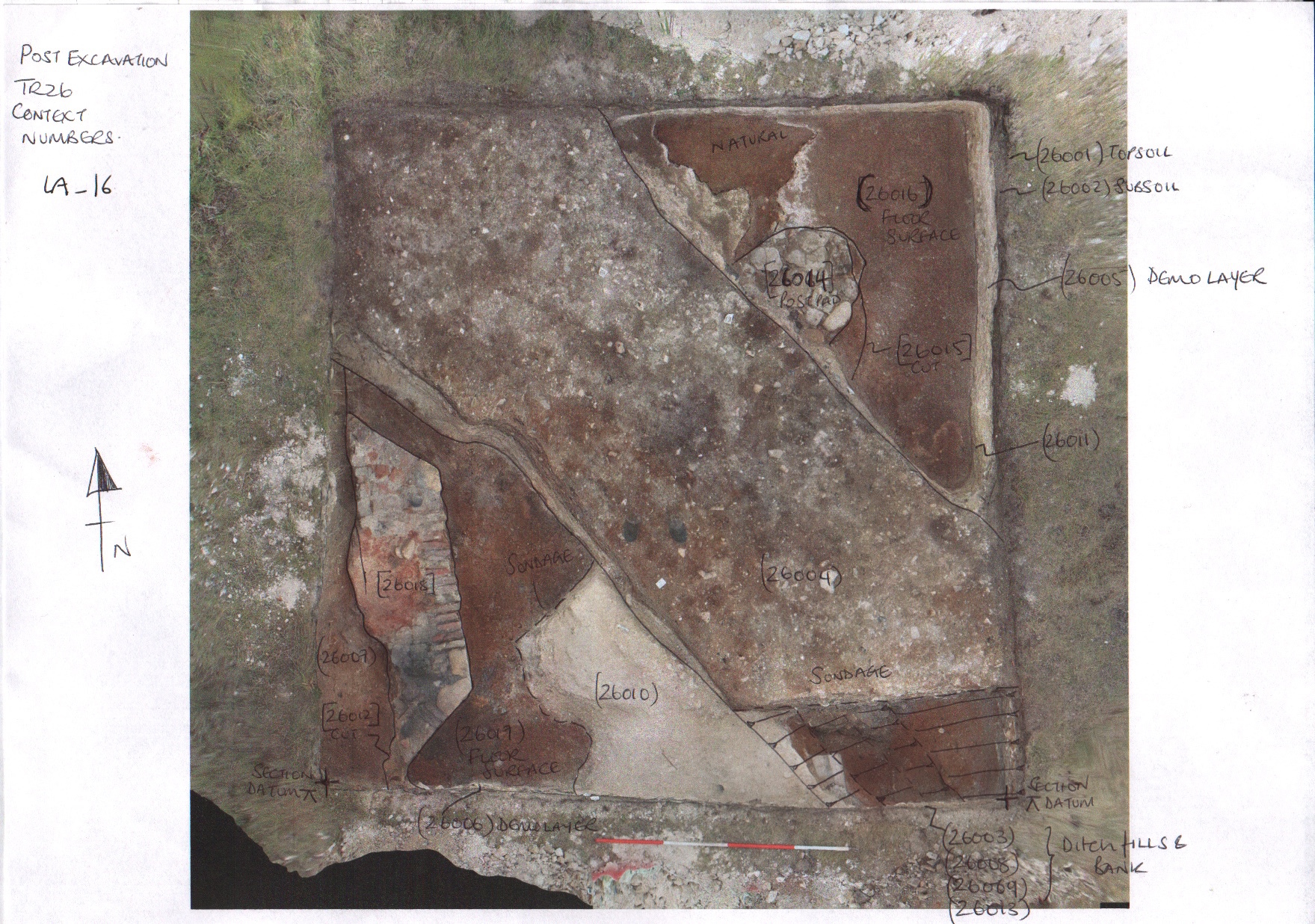
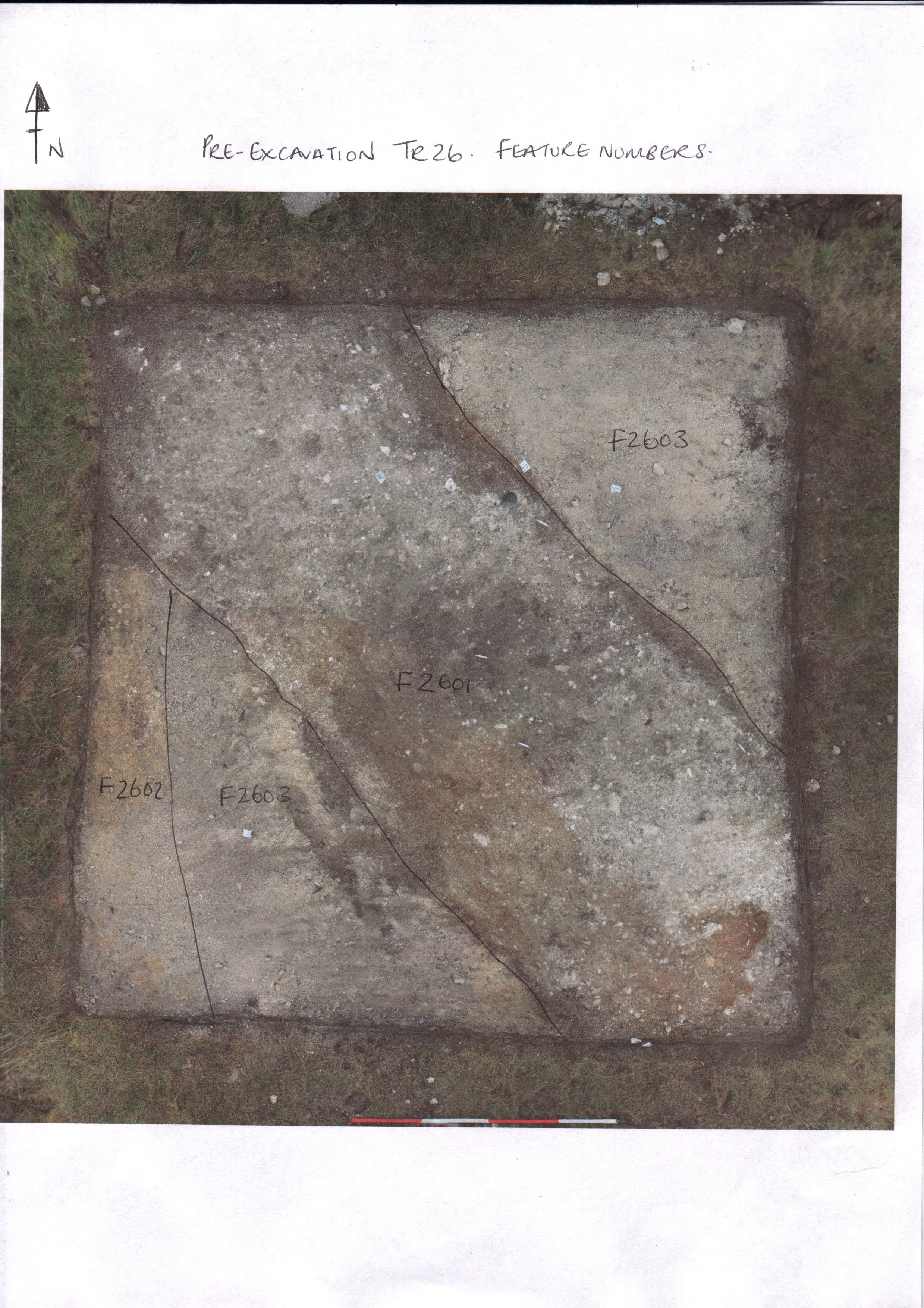
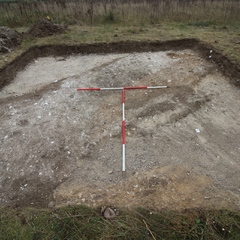
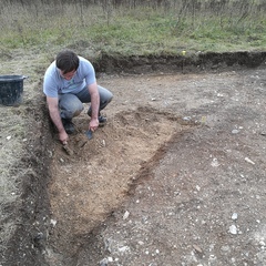
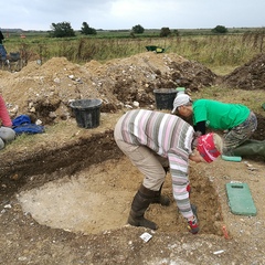
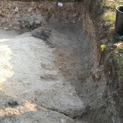
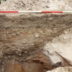
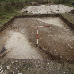
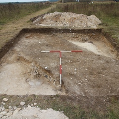
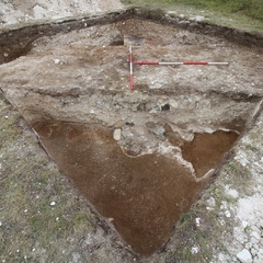
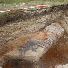
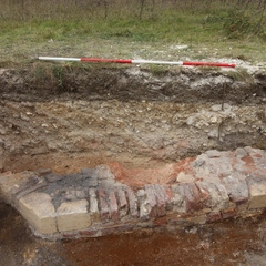
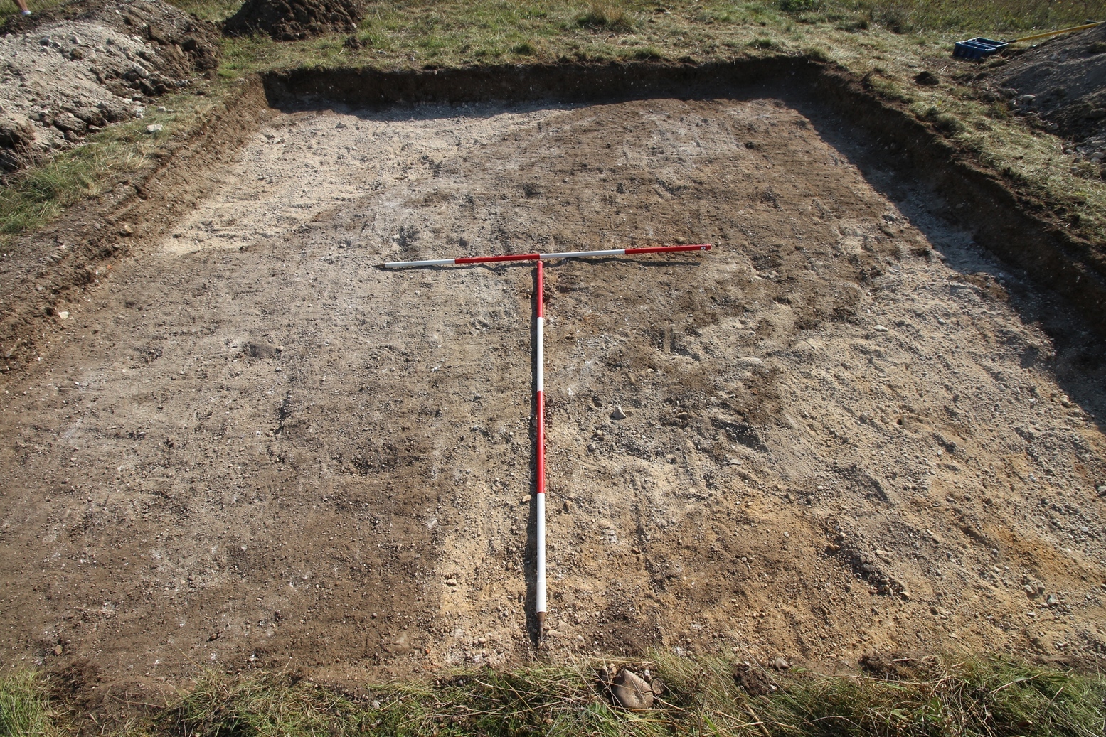
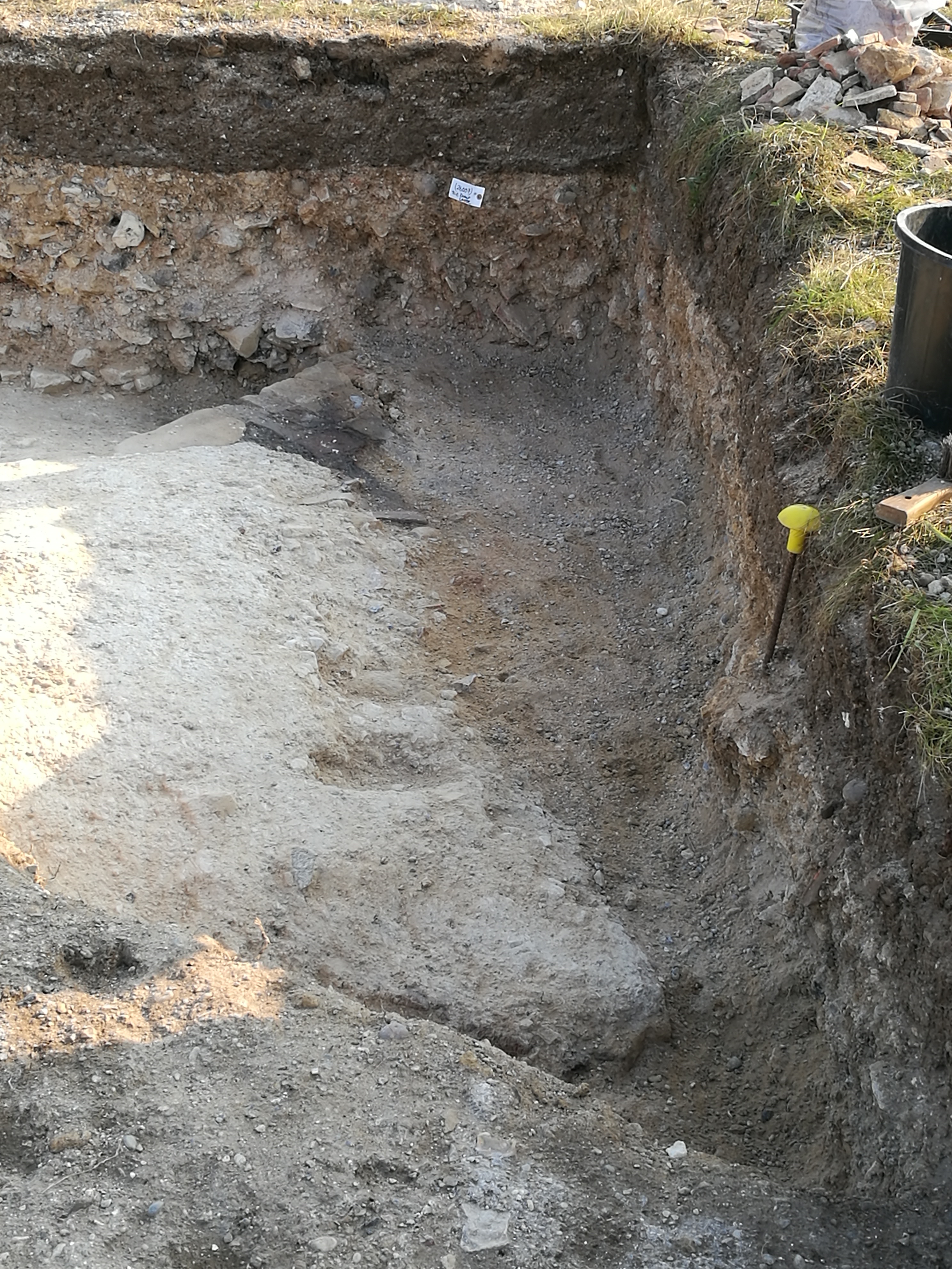
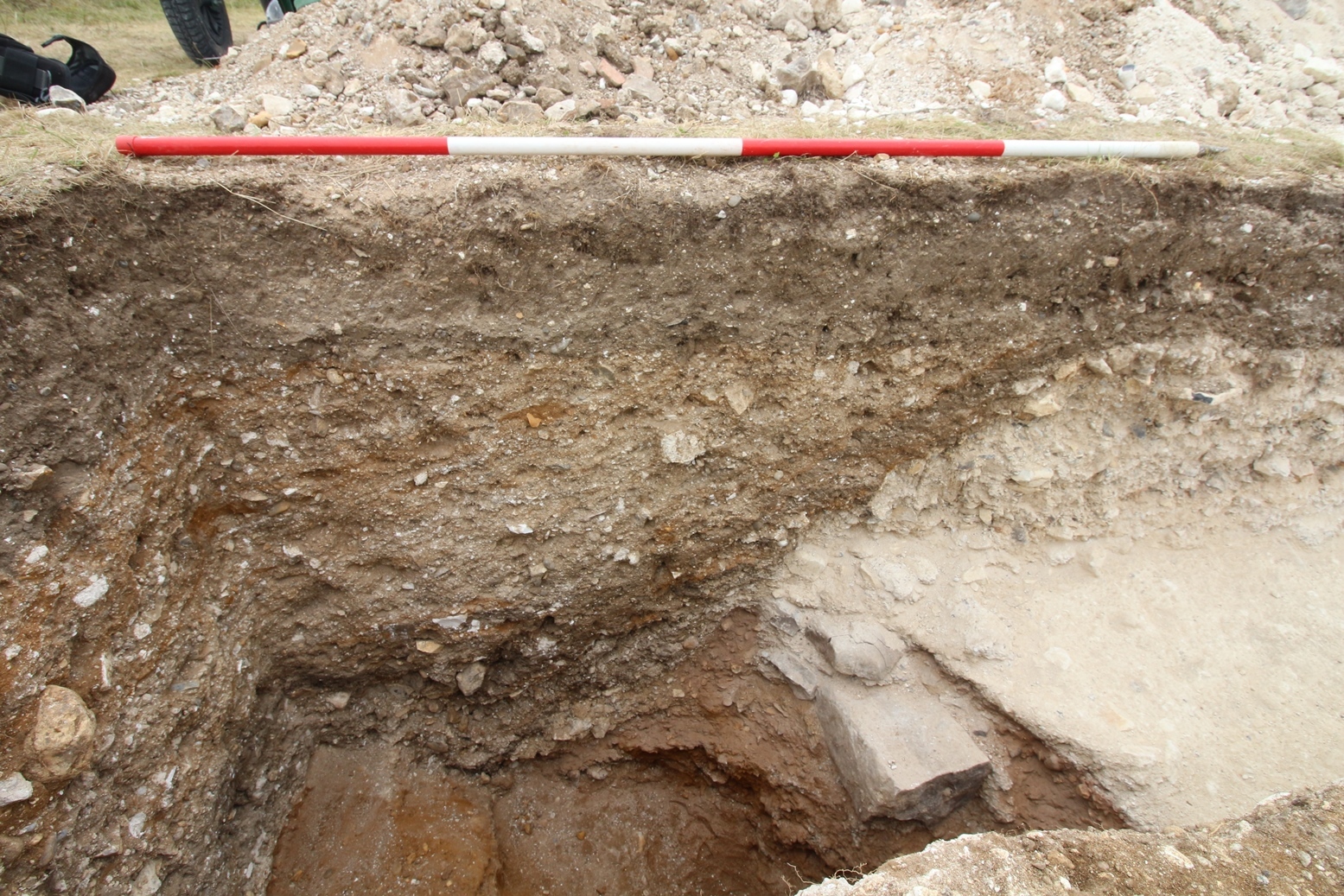
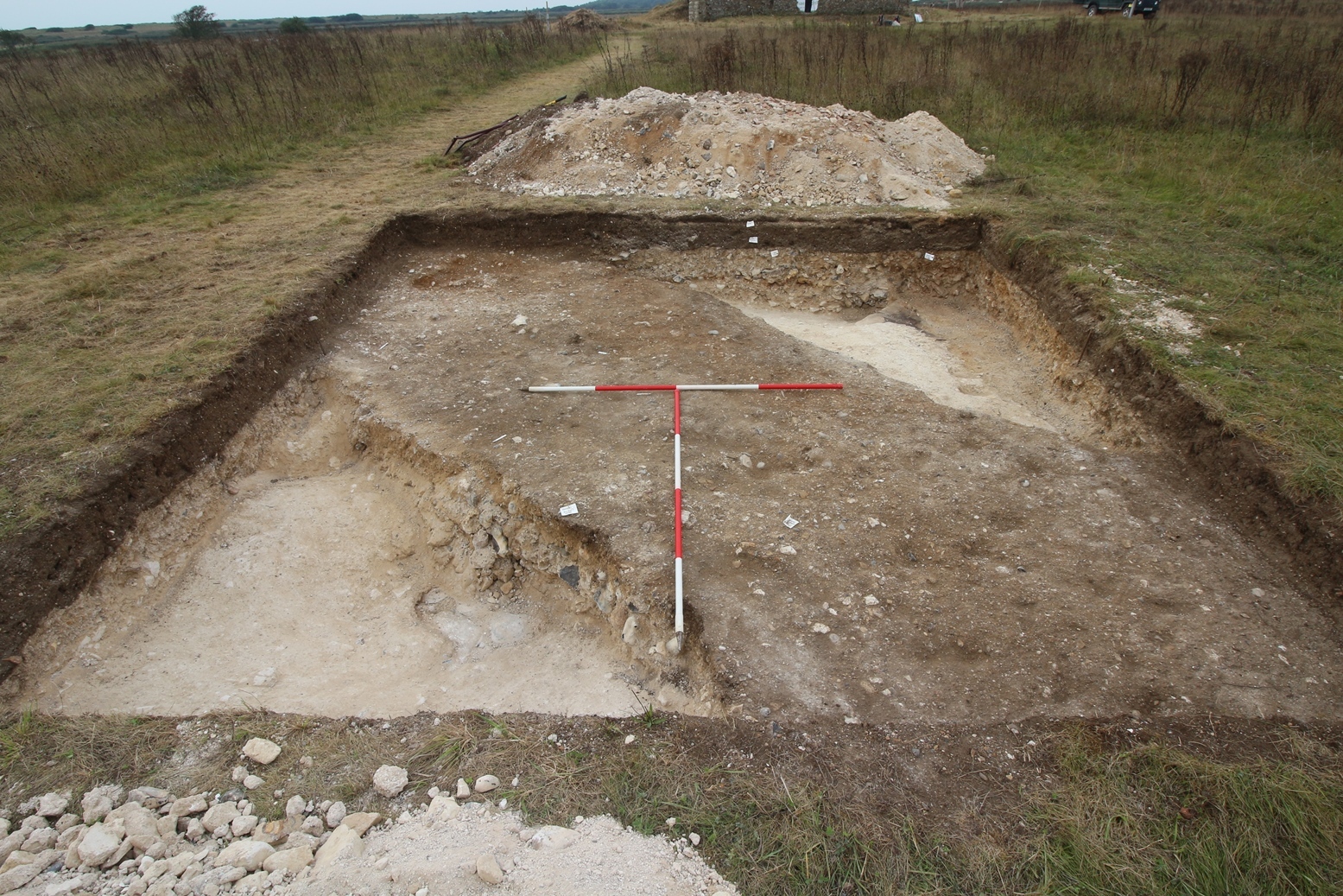
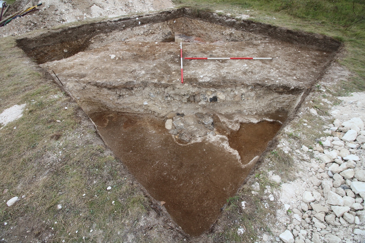
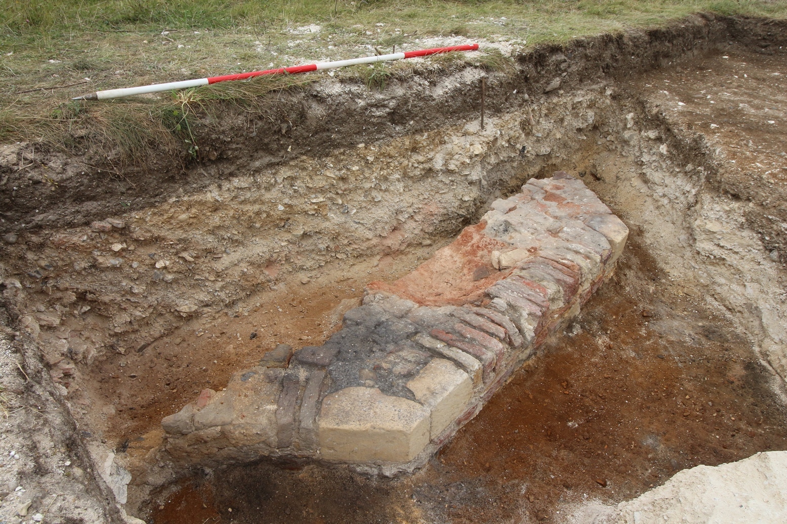
- Trench 26 measured 5 x 5m and was positioned to ground truth anomalies identified by resistance survey provisionally interpreted as a walkway or building connecting the cloister with an activity area to the north of the precinct. This Trench was successful in identifying activity related to the first use of the site by the Premonstratensian Abbey. The earliest activity in this trench consisted of a floor surface and post pad construction F2604 placed nearby to a Brick Hearth F2605 all built direct onto the natural sand. This suggests that these features represent construction during the first phase of building within the Trench and are probably contemporary to the first use of the site as an abbey complex. The later removal of the abbey in 1363 was also made clear by a levelling layer F2603 being found above these features. Two later ditches were then cut into this levelling layer. The first F2602 appears to show a robbing event although the extent of this intrusive ditch was not fully excavated. More substantial a second drainage ditch F2601 was located crossing the entire Trench. This ditch formed one of the latest feature on the site, it truncating earlier deposits within the Trench. It was filled over at least three episodes (26003, 26004, 26008), one of which indicated that it had been open for enough time for natural silting of the feature. Following this point the feature appears to have been re-used with it cut backfilled a suitable extent to form a causeway running NW to SE.
3-D Models
Plan
Section
- No records attached.
Features
-
Feature: LA_2601
- Drainage ditch and bank which was later adapted into a causeway. The ditch is one of the latest phases on site that truncates earlier deposits in trench 26 including the demolition phase of the abbey.
-
Feature: LA_2602
- Later cut intrusion and fill indicating a later phase of robbing out of the abbey complex. Full extent of the cut is unknown at the western end as this stops at the limit of excavation.
-
Feature: LA_2603
- The creation of the next levelling layer for the next phase of construction after the disuse of the earliest phase of the abbey and its subsequent destruction.
-
Feature: LA_2604
- Floor surface and post pad construction of earliest phase of Abbey
-
Feature: LA_2605
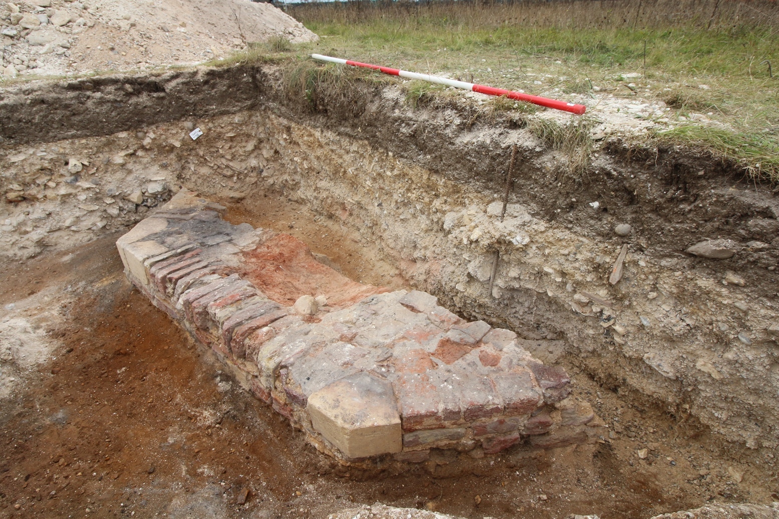
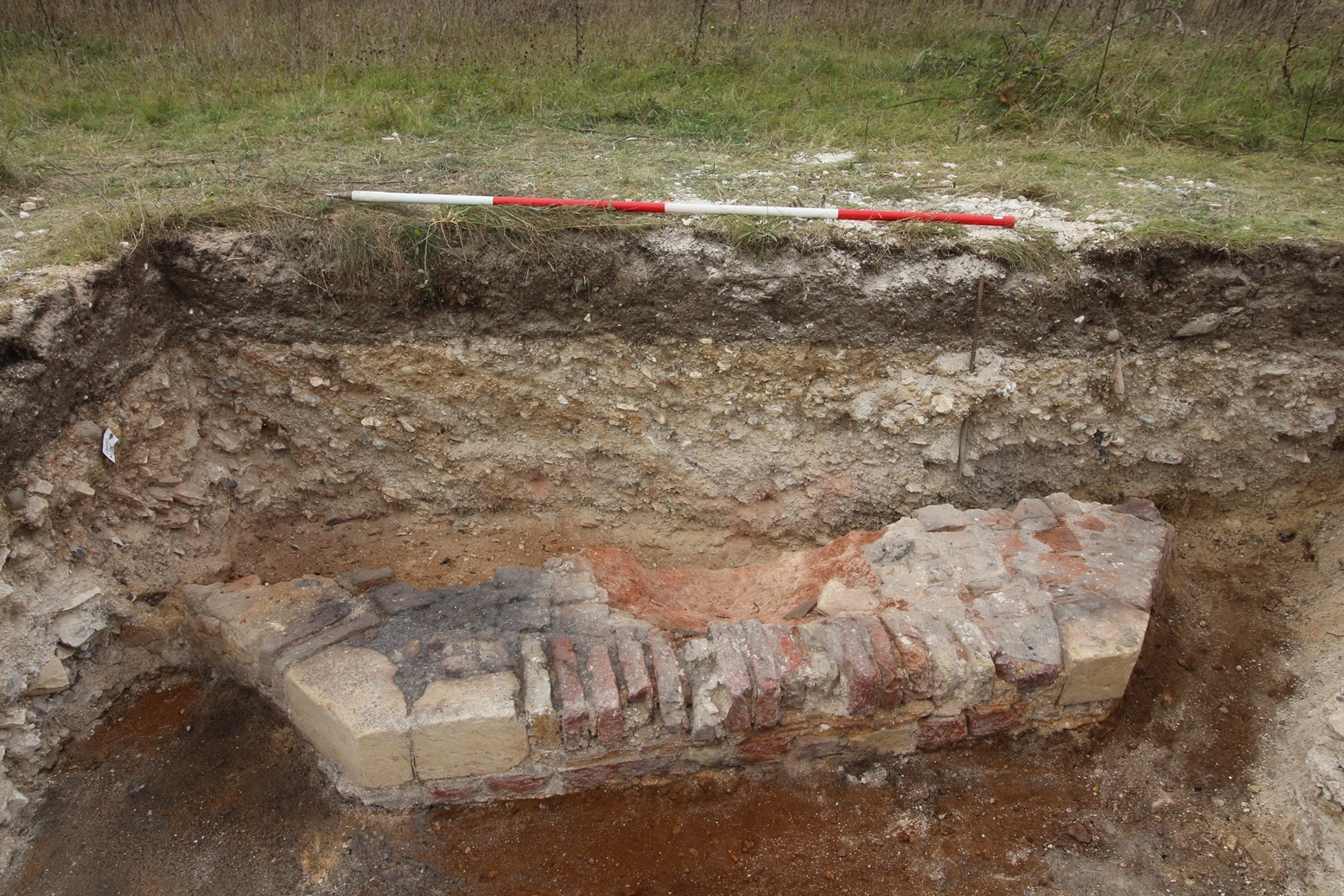
- Construction of brick hearth dating to Medieval period - attributed to first phase of building in Trench 26
-
Feature: LA_2606
- Construction of earliest chalk and silt floor surfaces directly constructed onto natural sand and gravels.
Contexts
-
Context: LA_26001
- Topsoil
- Lisa Westcott Wilkins
- 14-9-2016
-
Context: LA_26002
- Subsoil
- Raksha Dave
- 15-9-2016
-
Context: LA_26003

- Ditch fill of cut [26009]
- Johanna Ungemach
- 15-9-2016
-
Context: LA_26004
- Floor surface or causeway/ ditch backfill of cut [26009]
- Lisa Westcott Wilkins
- 15-9-2016
-
Context: LA_26005
- Demolition layer
- Lisa Westcott Wilkins
- 15-9-2016
-
Context: LA_26006

- Demolition layer
- Lisa Westcott Wilkins
- 15-9-2016
-
Context: LA_26007
- fill of [26012] demolition/robber backfill
- Manda Forster
- 20-9-2016
-
Context: LA_26008
- Primary fill of Ditch cut [26009]
- Raksha Dave
- 22-9-2016
-
Context: LA_26009

- Cut of drainage ditch filled with (26008), (26003), (26004) and bank (26013)
- Raksha Dave
- 23-9-2016
-
Context: LA_26010
- Chalk mortar levelling layer (west)
- Raksha Dave
- 23-9-2016
-
Context: LA_26011
- Chalk mortar levelling layer (East)
- Raksha Dave
- 23-9-2016
-
Context: LA_26012

- linear cut running N-S
- Raksha Dave
- 23-9-2016
-
Context: LA_26013

- Bank of ditch cut [26009]
- Raksha Dave
- 23-9-2016
-
Context: LA_26014

- Post Pad
- Raksha Dave
- 23-9-2016
-
Context: LA_26015

- Cut of post pad
- Raksha Dave
- 25-9-2016
-
Context: LA_26016
- Floor surface
- Raksha Dave
- 25-9-2016
-
Context: LA_26017
- Floor surface
- Raksha Dave
- 25-9-2016
-
Context: LA_26018
- Truncated medieval hearth
- Raksha Dave
- 25-9-2016


- Brendon Wilkins 13-9-2016