Basic Information
- Shaft
Contexts
-
Context: JNP_1005
- Shaft
- Manda Forster
- 17-4-2018
Narrative
-
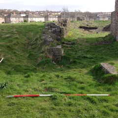
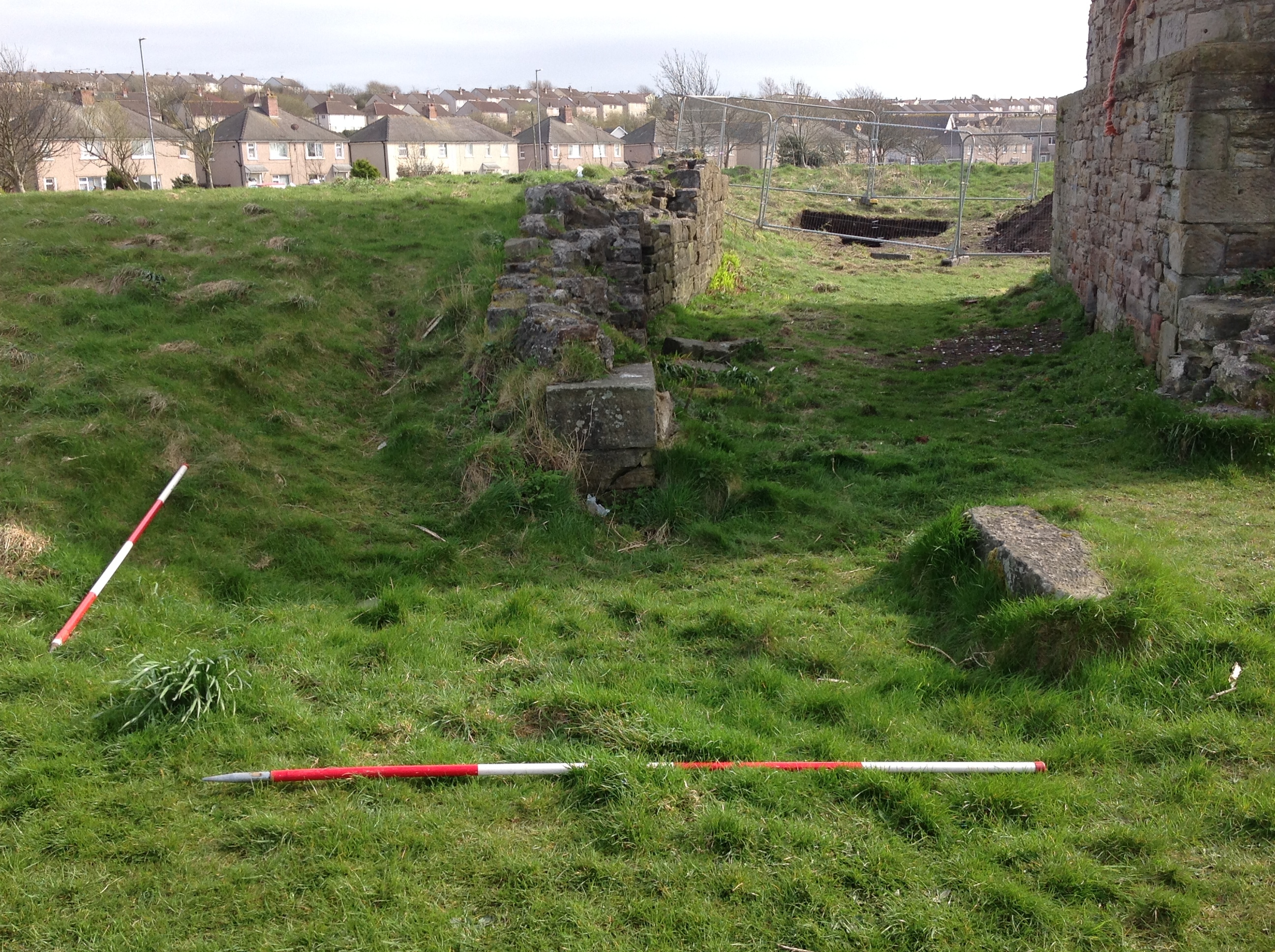
- Feature recorded during site assessment originally published in the landscape survey report (Quartermaine, H. 2016 Jane pit, Workington, Cumbria; Desk-Based Assessment and Landscape Survey Report, Report No. 2016-17/1770. Oxford Archaeology North). OS mapping and the 1949 aerial photograph show the location of the Jane Pit shaft as being to the north-west of the engine house. The RAF photograph shows that it was on the surface a circular stone constructed drum, about 7-8m across and was located no more than 5-10m from the north-western corner of the engine house base, at the end of the retaining wall extending out from the gin pit (Feature 1.1). The standing structure is no longer extant and it is to be presumed that the shaft has been capped and covered, but there is a slight earthwork hollow at the northern end of the extant retaining wall, which would appear to correspond in location to the former shaft. Although the vegetation cover in this location is not particularly dense, cutting it back may allow further clarification of the form of the shaft.
-
- Manda Forster
- 17-4-2018
Dating Narrative
-
- Part of original works, 1834
-
- Manda Forster
- 17-4-2018
Matrix
-
- [not set]
- [not set]