- Trench 2
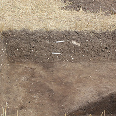
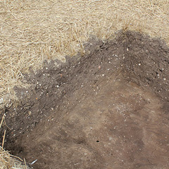
Photos

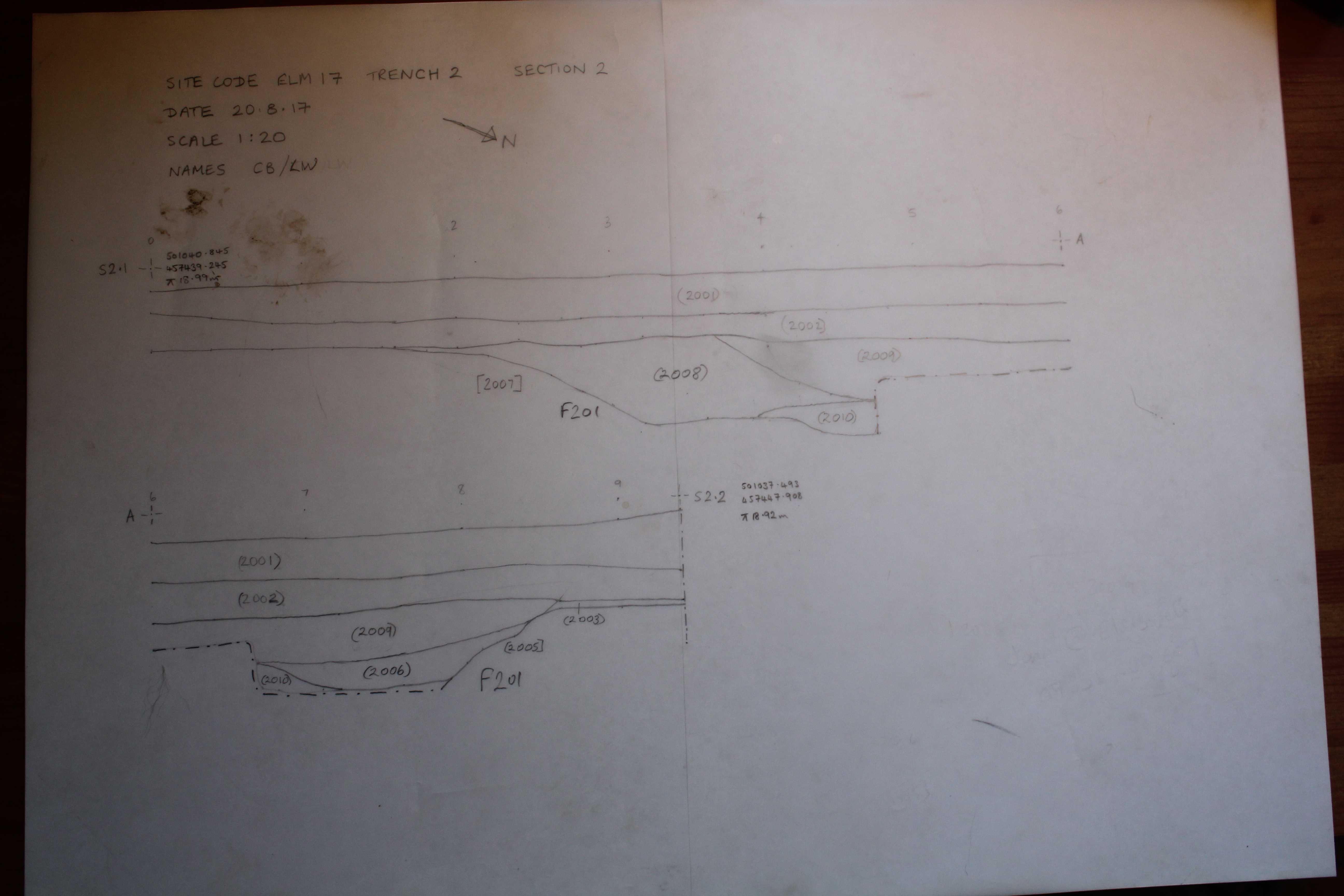
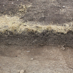
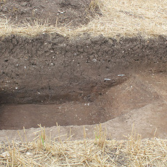
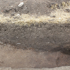
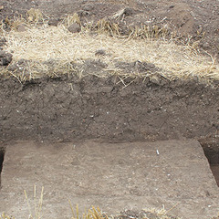
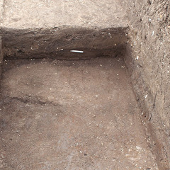
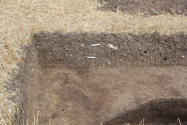
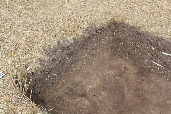
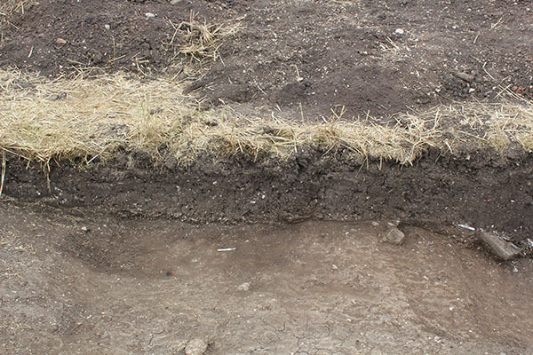
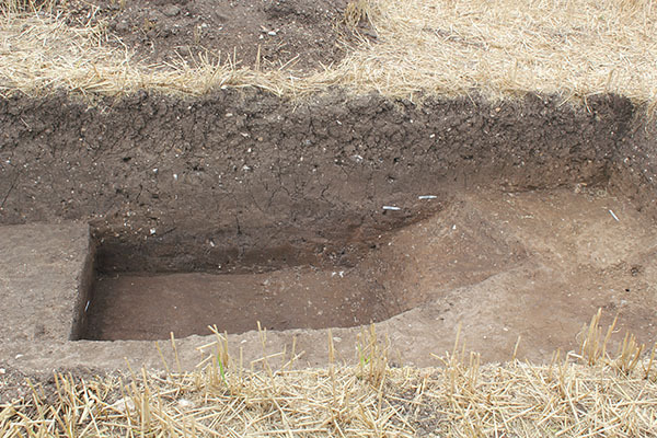
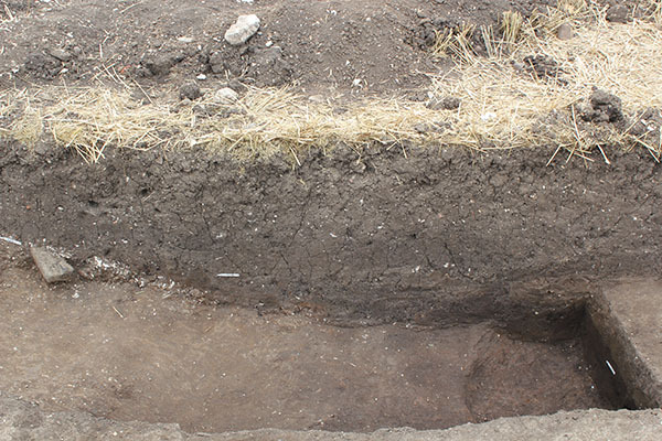
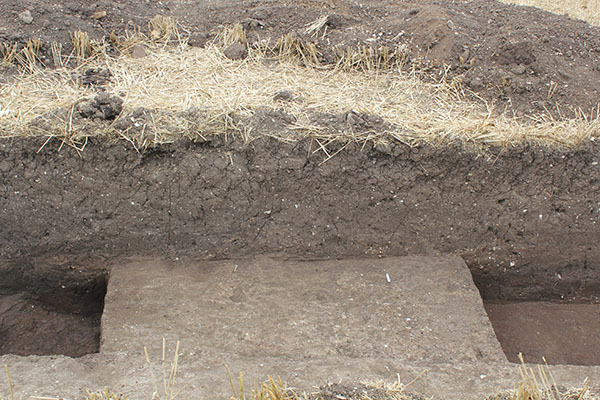
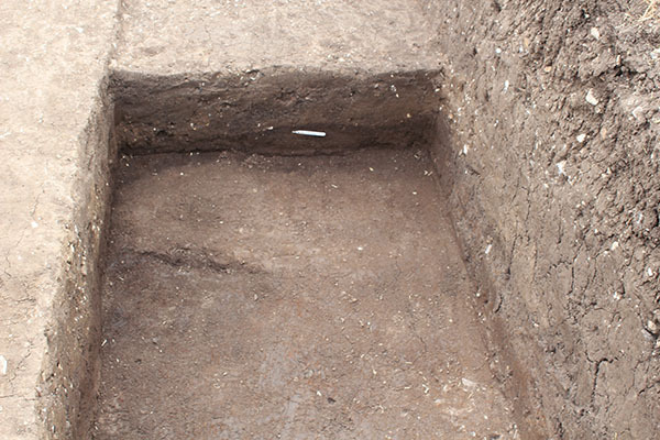
- Trench 2 measured 10m x 2m and targeted a linear cropmark identified from aerial photographs, LiDAR data and historical OS maps as a probable watercourse serving a spring to the west. It was excavated by machine down to the top of the geology, where it was visible, and to the top of the deposits below the subsoil across the rest of the trench. One large, 8m wide feature (F201) occupied much of the trench. Initially it was thought that the east to west aligned cuts identified at either end of the trench [2005] and [2007] were discrete features; however, upon investigation the deposits found within them were the same. The base of the ditch was not reached during excavation due to safety concerns regarding the depth of the trench. The southern edge of the ditch was cut into a geological layer (2004) of sandy clay, and at the northern end into a slightly lighter clay layer (2003), believed to be a layer or fill of another feature. This archaeological layer was not fully investigated but did pre-date the construction of the ditch; unfortunately, no dating evidence was recovered. The earliest fill of the ditch was a 0.12m deposit of dark organic-rich silt (2010) from which no finds were recovered. Following this, at the northern end of the trench, a later fill (2006) had accumulated, producing a single sherd of medieval Beverley ware pottery dating from the early 13th to the early 14th century. The fill (2008) overlying this deposit on the southern side of the ditch contained 19 sherds of medieval pottery, including seven of sherds of Humberware datable to between the late 13th and late 15th century. A copper alloy dress hook SF24 found in this fill suggests a slightly later 16th century date for its deposition. No stratigraphic relationship was established between these two deposits although both were overlain by a final, tertiary deposit (2009) that produced six sherds of pottery, including a sherd from a Cistercian ware cup that dates to c.1450 – c.1600. The subsoil (2002) in Trench 2 sealed the entirety of the ditch; and this, in turn, was sealed by the ploughsoil (2001). The pottery identified from both layers was very similar to that found in the upper fills of the ditch, and no sherds later than the 16th century were found at all.
3-D Models
Plan
-
Plan: ELM_2
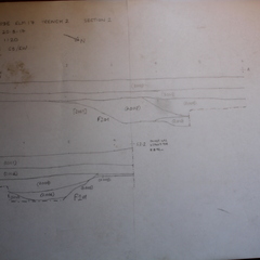
- Post-excavation plan of Trench 2
- Maiya Pina-Dacier
- 21-8-2017
Section
-
Section: ELM_2
- Trench 2 east facing baulk section
- Helen Moss
- 20-8-2017
Features
-
Feature: ELM_201
- Drainage ditch aligned east to west
Contexts
-
Context: ELM_2001

- Topsoil
- Emma Lacey
- 15-8-2017
-
Context: ELM_2002
- Subsoil
- Rebecca Jones
- 15-8-2017
-
Context: ELM_2003
- Mid brown clay at north end of trench
- Rebecca Jones
- 15-8-2017
-
Context: ELM_2004
- Mid brown clay at south end of trench
- Rick Barnett
- 15-8-2017
-
Context: ELM_2005

- Ditch aligned northeast to southwest at north end of Trench2
- Chris Casswell
- 16-8-2017
-
Context: ELM_2006
- Fill of ditch aligned northeast to southwest
- Chris Casswell
- 16-8-2017
-
Context: ELM_2007
- Cut of ditch aligned east to west at south end of Trench 2
- Chris Casswell
- 16-8-2017
-
Context: ELM_2008

- Fill of ditch at south end of trench 2
- Chris Casswell
- 18-8-2017
-
Context: ELM_2009
- Mixed layer formed withing depression between [2005] and [2007]
- Chris Casswell
- 18-8-2017
-
Context: ELM_2010
- Dark 'peaty' fill
- Chris Casswell
- 19-8-2017


- Brendon Wilkins 18-8-2017