- Trench 1
Photos
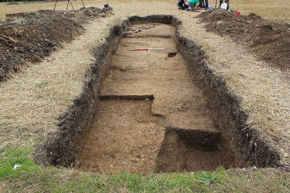
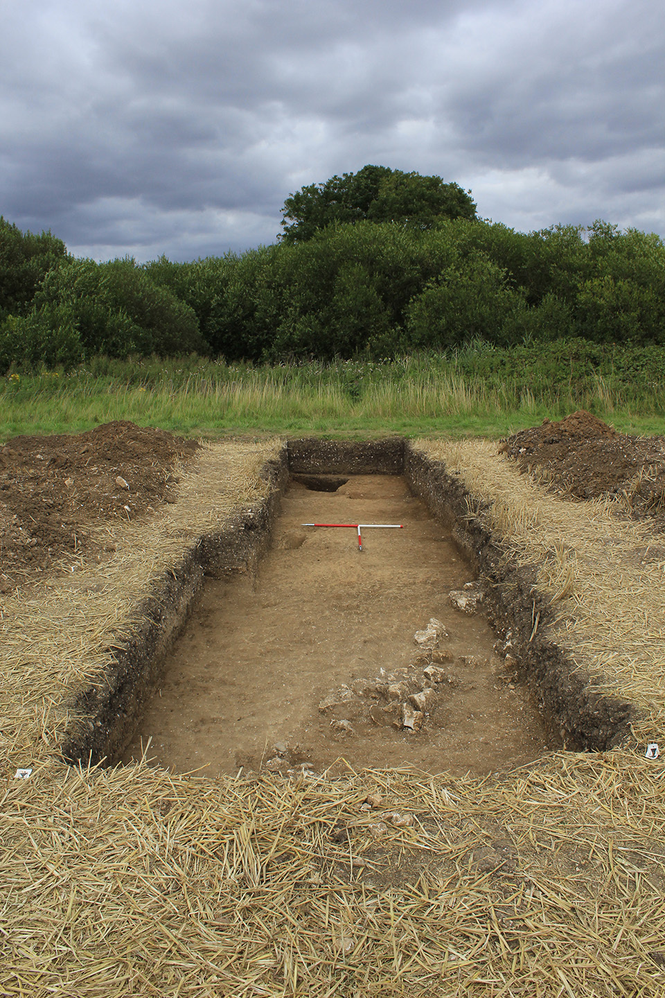
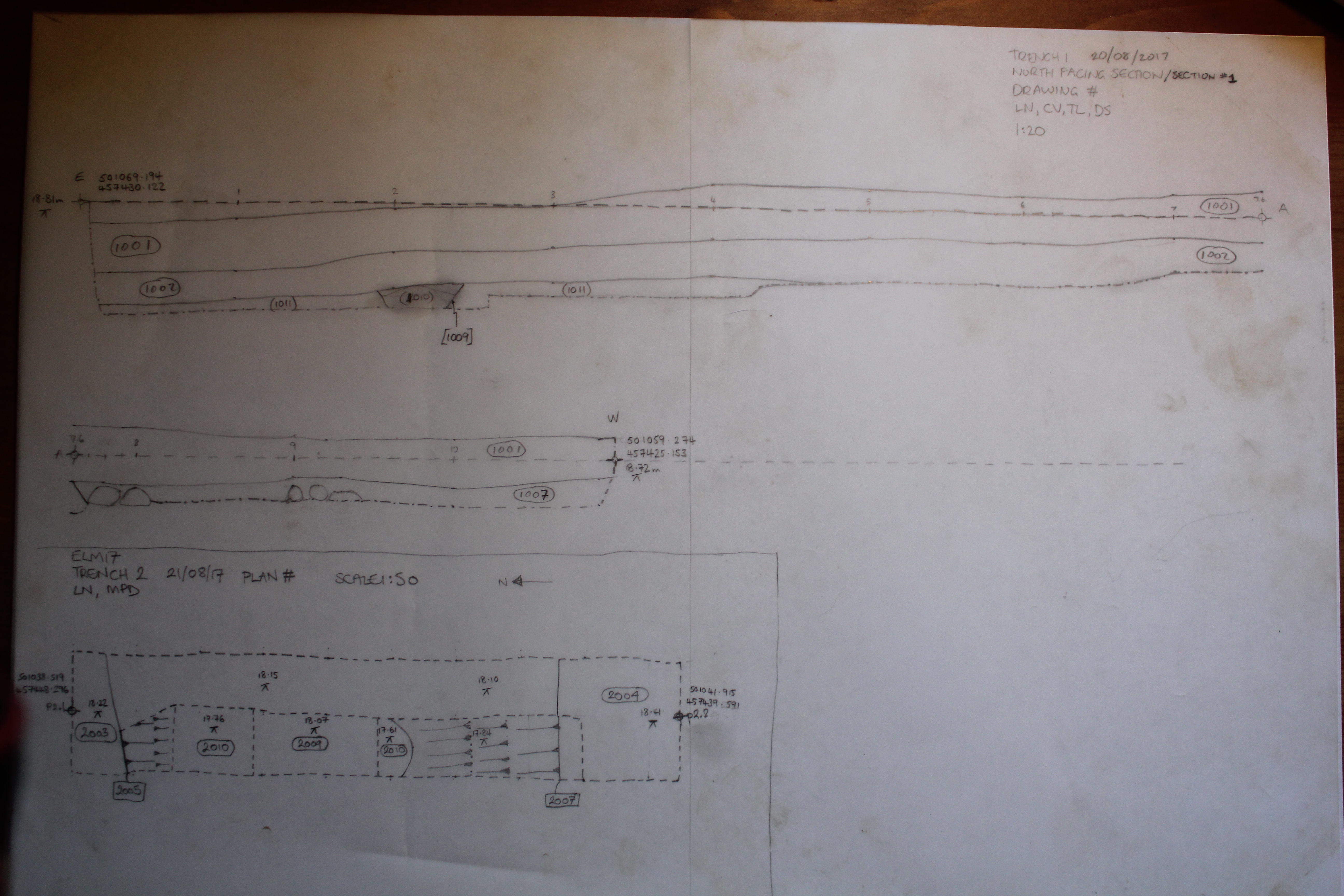
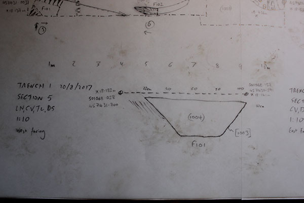
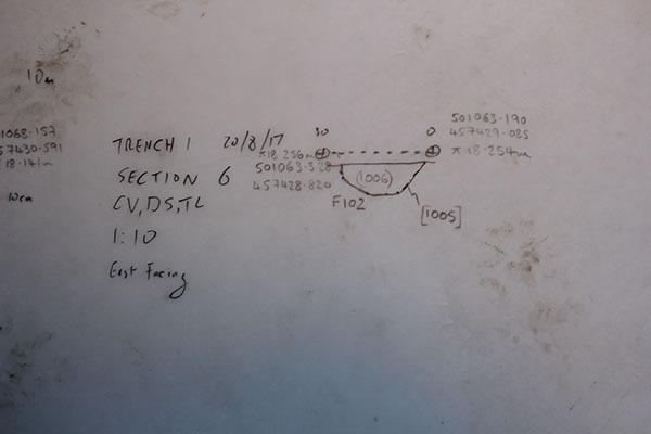
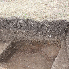
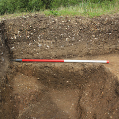
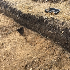
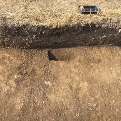
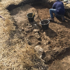
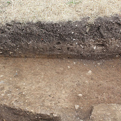
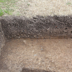
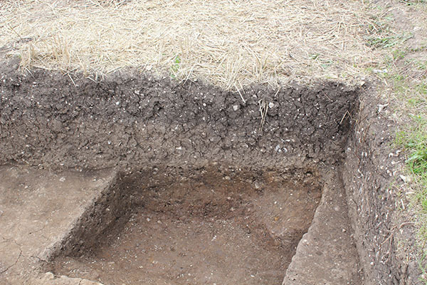
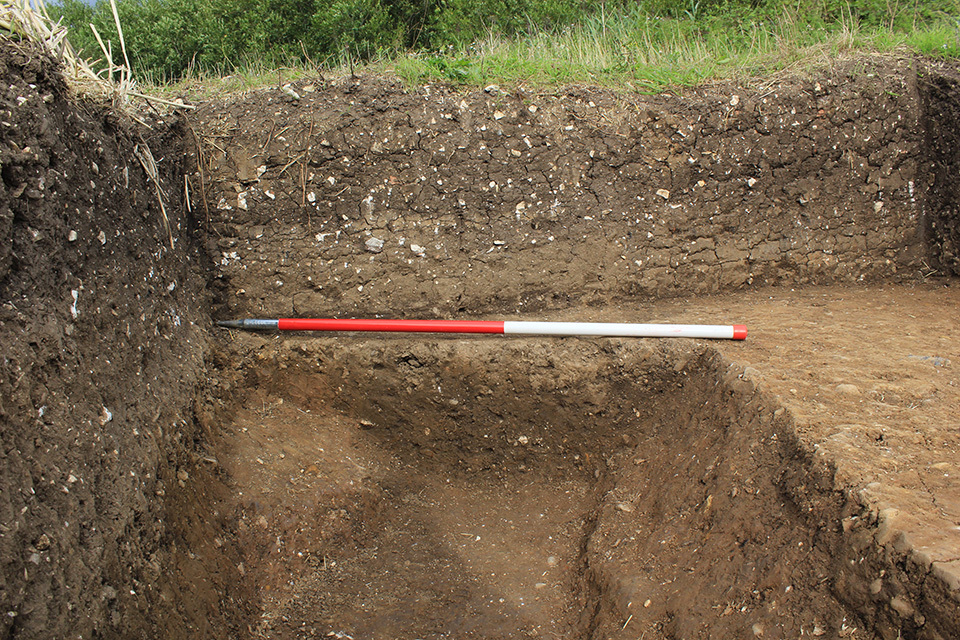
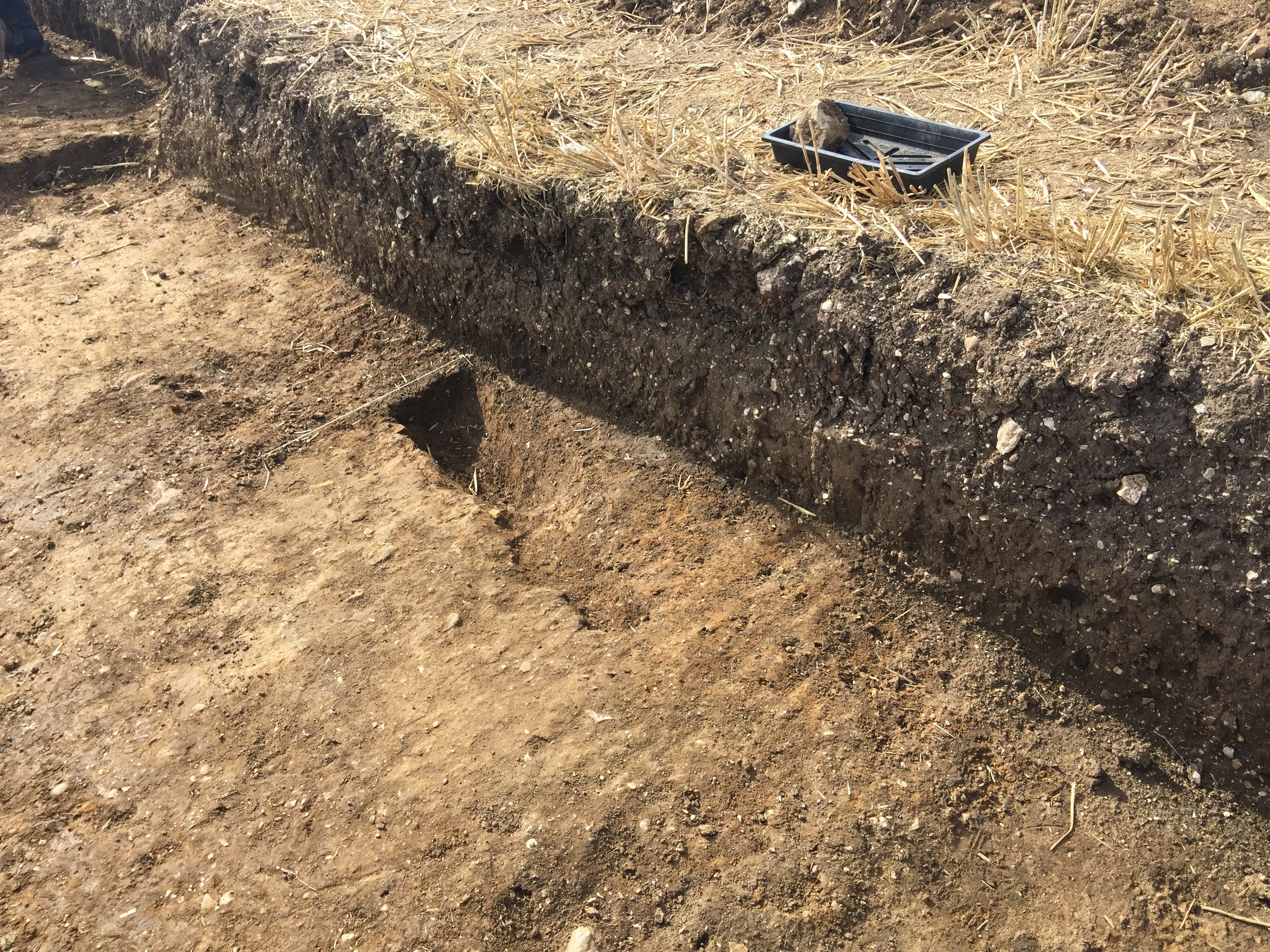
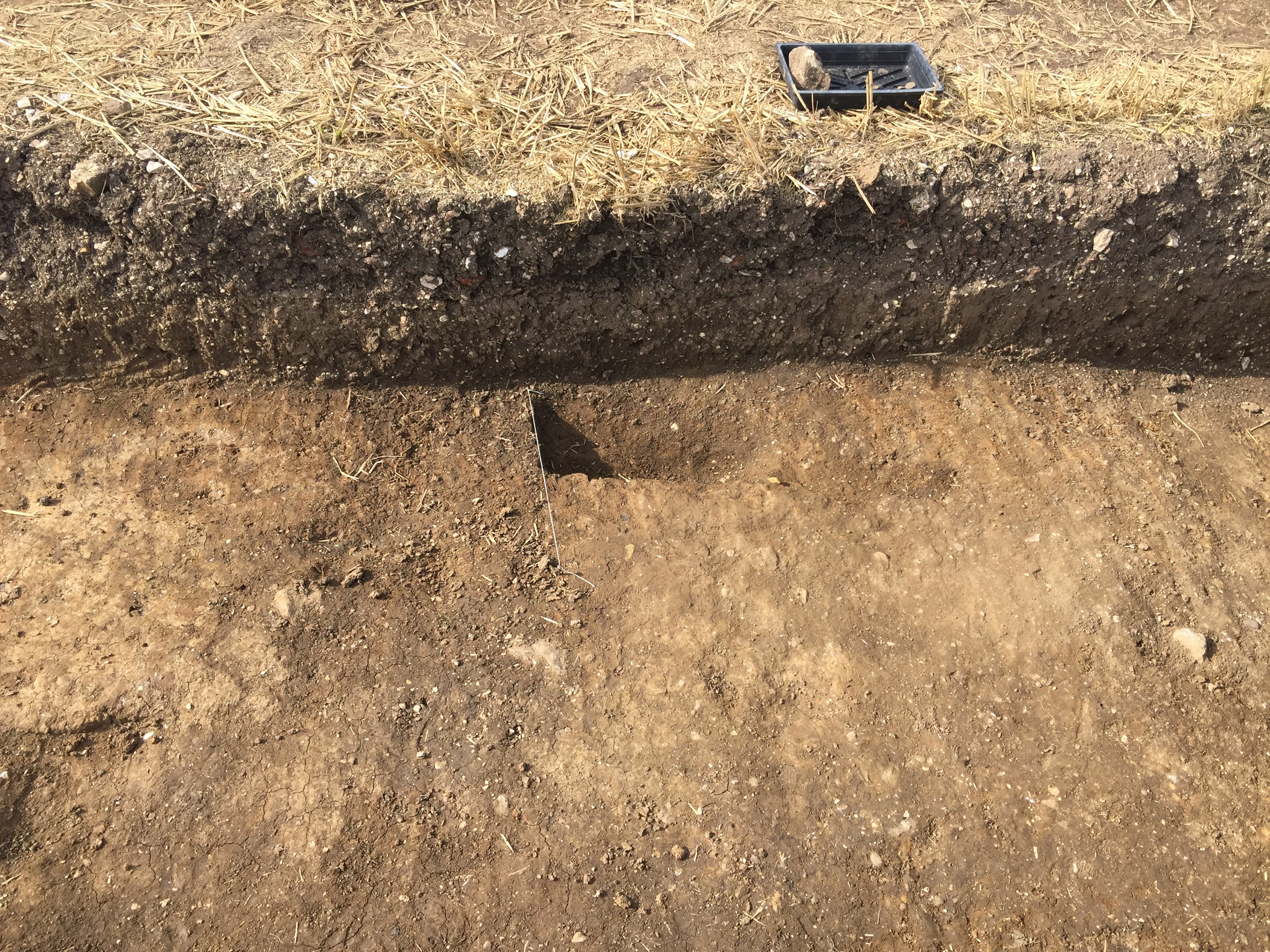
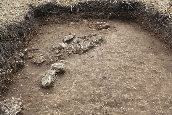
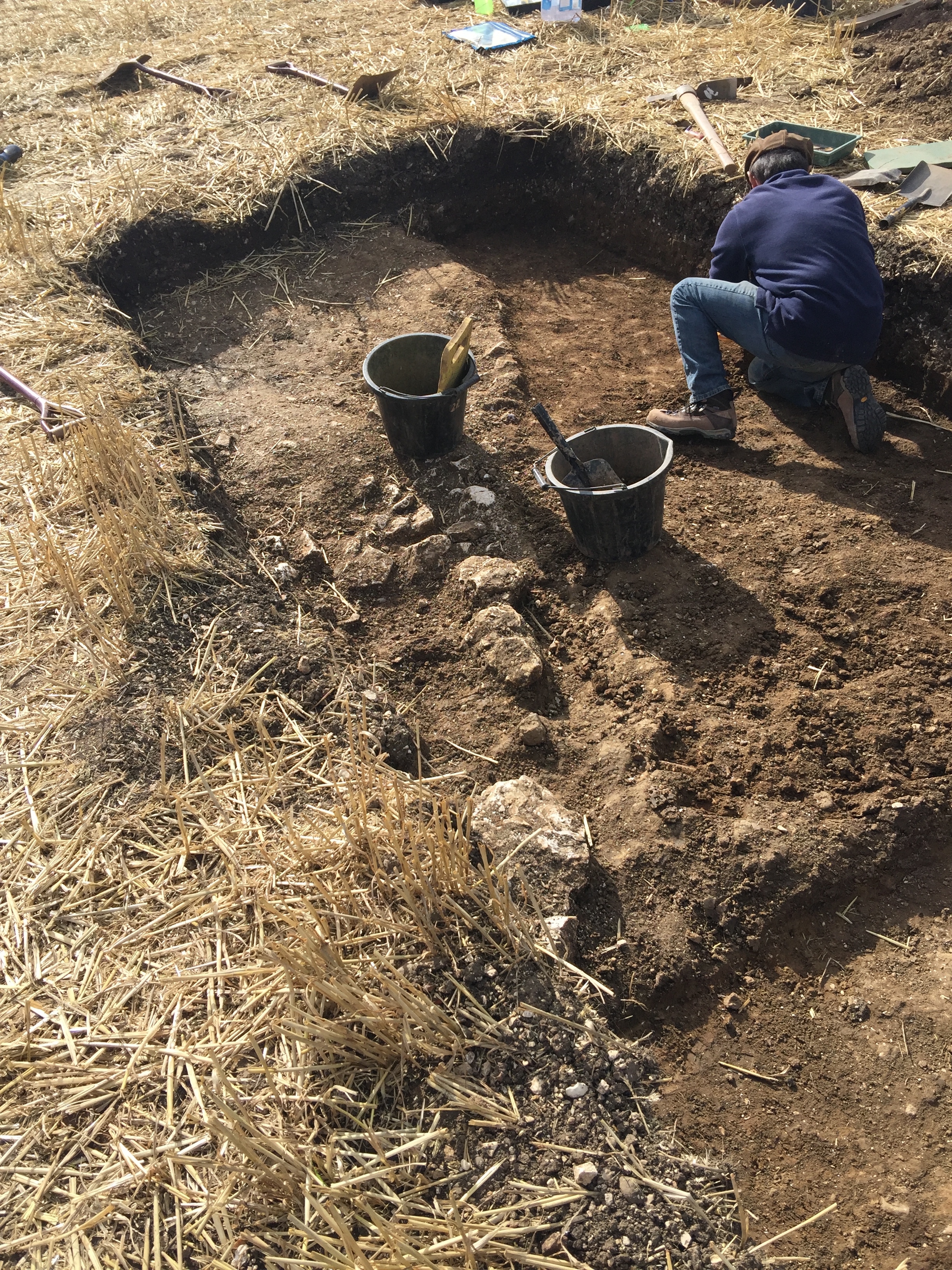
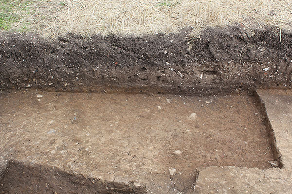
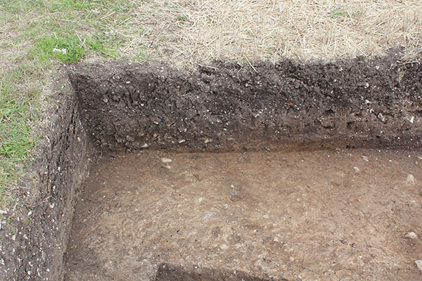
- Trench 1 measured 10m x 2m and targeted a linear cropmark identified from aerial photographs and LiDAR data. However, upon inspection of the site, the location of Trench 1 was moved approximately 8m to the west to avoid potentially impacting on the SSSI. The trench was excavated by machine to the top of the subsoil layer in the western part of the trench where cut archaeological features were encountered. In the eastern part, the trench was excavated to the top of the geological horizon as no features were recorded in the subsoil. Three cut features were identified below the subsoil horizon. The earliest remains found are represented by a single, partially excavated pit or terminal end of a ditch F103, found at the eastern end of the trench. The cut [1009] visible within the excavation area had a circular shape in plan and contained within its fill (1010) three small sherds of medieval pottery, two of which date to the late 11th to mid 12th century. At the eastern end of the trench an east to west aligned ditch F101 was recorded, comprising a straight, linear cut [1003]. Two sherds of sandy ware medieval pottery from the ditch fill (1004) suggest the deposit dates to the late 13th to early 14th century. A mixed assemblage of animal bone was also recovered from the fill and includes cattle, sheep/goat, pig, horse and dog. A smaller, curving ditch F102 was found at the same stratigraphic level in the centre of the trench; its cut [1005] was filled by a grey silt (1006) and produced no finds. This was the only curving feature found on site and was initially interpreted as a fragment of poorly preserved ring ditch, possibly of Iron Age date; however, excavation was unable to prove this hypothesis. Subsoil (1002) / (1008) identified in Trench 1 was up to 0.3m thick and overlay the medieval features to the east, meaning that it must have formed no earlier than the late 13th century. Pottery found in this layer dates to between the late 11th and 14th century, but is likely to have been displaced from deposits situated up-slope to the west. This layer was not found in either of the other trenches, where medieval remains were encountered directly beneath the ploughsoil. Ploughing and natural soil erosion appears to have contributed to the displacement of material from higher ground down to lower levels towards Elmswell Beck. Subsoil at the western end of the trench was hand-excavated due to the presence of archaeological deposits at a higher level. A linear arrangement of large, angular chalk stones (1007) was found within a light grey pea-gravel matrix overlying and embedded within the subsoil. A small assemblage of eight fragments of animal bone was recovered from the soil matrix surrounding the stones, including one identified as the tooth of a pig, but no dateable finds. The stones are unlikely to represent the in-situ remains of a wall or yard surface, but may be debris from a nearby wall truncated by modern ploughing. The results from Trench 1 have highlighted the presence of medieval features from at least two phases of activity: the late 11th to 12th, and the late 13th to early 14th century. The subsoil overlying them was notable in that the pottery assemblage contained no sherds post-dating the 14th century, suggesting that this layer formed soon after this time, most probably drawn down from a higher, more extensive area of activity to the west.
3-D Models
Plan
-
Plan: ELM_1
- Post-excavation plan of Trench 1
- Charlotte Vanderwalk
- 20-8-2017
Section
Features
Contexts
-
Context: ELM_1001
- Topsoil
- Gill Haynes
- 15-8-2017
-
Context: ELM_1002

- Subsoil
- Hannah Brazier
- 15-8-2017
-
Context: ELM_1003
- Ditch aligned east to west in east end of trench
- Gill Haynes
- 16-8-2017
-
Context: ELM_1004

- Fill of ditch aligned east to west in east end of trench
- Gill Haynes
- 16-8-2017
-
Context: ELM_1005
- Curvi-linear ditch centre of trench
- Jonathon Leach
- 16-8-2017
-
Context: ELM_1006
- Fill of curvi-linear ditch centre of trench
- Jonathon Leach
- 16-8-2017
-
Context: ELM_1007
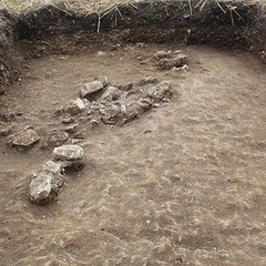
- Chalk stone layer at west end of trench
- Emma Lacey
- 16-8-2017
-
Context: ELM_1008
- Layer adjacent to wall feature, west end of trench 1
- Steve Manus
- 18-8-2017
-
Context: ELM_1009
- Unexcavated pit at east end of trench
- Chris Casswell
- 24-8-2017
-
Context: ELM_1010

- Fill of unexcavated pit at east end of trench
- Chris Casswell
- 24-8-2017
-
Context: ELM_1011
- Natural
- Chris Casswell
- 24-8-2017


- Brendon Wilkins 18-8-2017