Basic Information
- Enclosure ditch
Contexts
-
Context: EPR_1005

- Upper fill of enclosure ditch
- David Bowles
- 20-6-2019
-
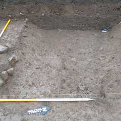
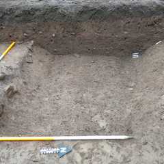
Context: EPR_1006
- Cut of enclosure ditch
- Sara Gibson
- 20-6-2019
-
Context: EPR_1013
- Secondary fill of ditch [1006]
- Scott Williams
- 25-6-2019
-
Context: EPR_1013
-
- Secondary fill of ditch [1006]
- Scott Williams
- 25-6-2019
-
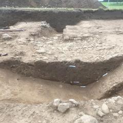
Context: EPR_1014
- Dark grey silty clay layer with charcoal inclusions in ditch [1006]
- Susan Wilson
- 25-6-2019
-
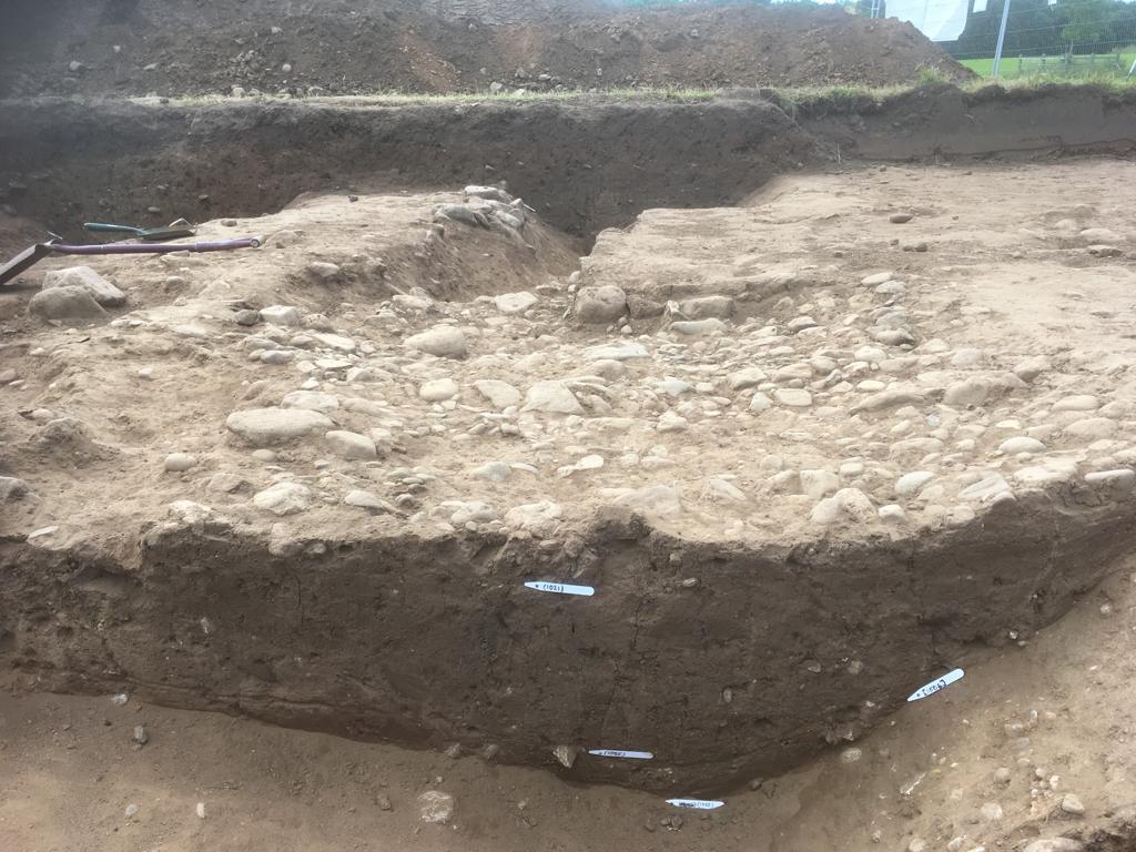
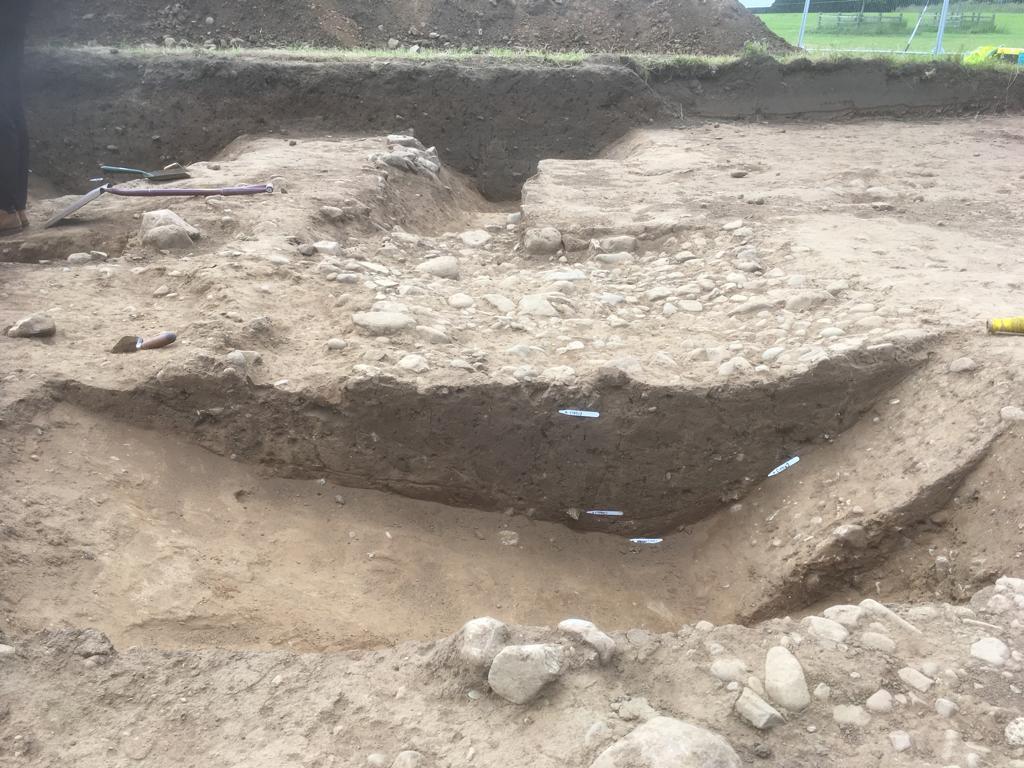
Context: EPR_1021
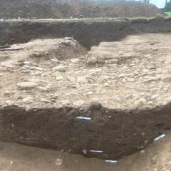
- Stone layer at top of ditch [1006]
- Carl Hood
- 28-6-2019
-
Context: EPR_1022

- Sand fill in ditch [1006]
- Beth Cochrane
- 28-6-2019


Narrative
-
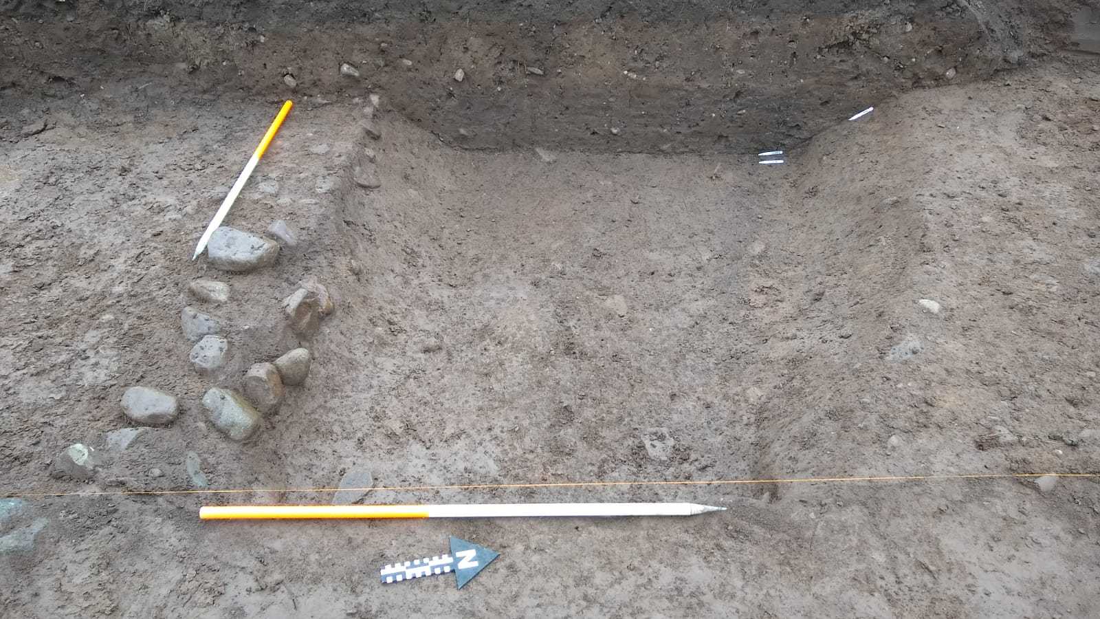
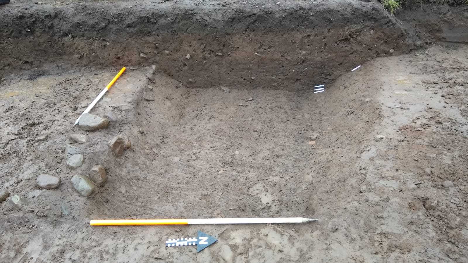
- This enclosure ditch appeared to be the latest Roman feature observed within the trench. The ditch, which had an open V shaped profile, cut through the roadside ditch (104) and the boundary ditch (109). The infill of the enclosure ditch was partially cobbled/metalled over along a discrete area of its length. The purpose of this metalling remains open to debate, but it possibly represents the installation of an access way between adjacent domestic plots where the soils within the ditch may have retained moisture or were soft.
-
- David Bowles
- 8-7-2019
-
- A large ditch F105 with a V-shaped profile appeared to be the latest Roman feature observed within the trench. From the geophysics the ditch can be identified as square in plan. It measured 2.05m wide and 0.65m deep. It seems likely that it functioned as an enclosure ditch demarcating property boundaries. The ditch was filled with clayey-sand deposits, (1005), (1013), (1014) and (1022). 5.4.2 This enclosure ditch cuts through the trackway and associated ditch, and early boundary ditch. It is likely that this enclosure was part of a ladder settlement built along the track. The ditch was partially infilled by a cobble surface (1021) extending along its length. The purpose of this cobbling remains open to debate, but could represent the installation of an access way between adjacent domestic plots where the soils with the ditch may have retained moisture making the ground too soft.
-
- Indie Jago
- 1-10-2020
Dating Narrative
-
- Sixty-three pot sherds where found within the ditch, from the upper layers (1005), (1013) and (1014), they date the ditch 3rd/4th century AD. Two handmade sherds may have been incorporated into the enclosure ditch fill due to it truncating F109, or due to residue Iron Age material remaining on the surface.
-
- Indie Jago
- 1-10-2020